
|
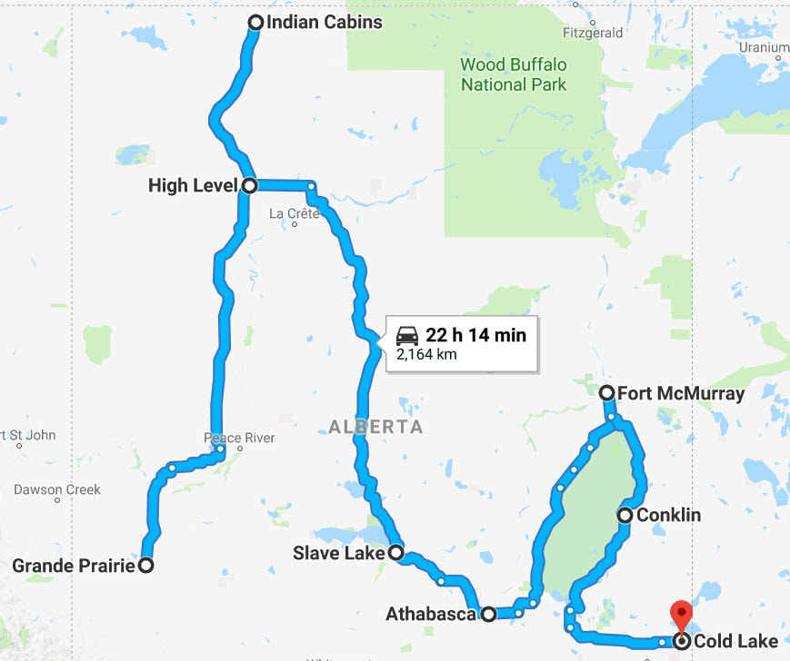
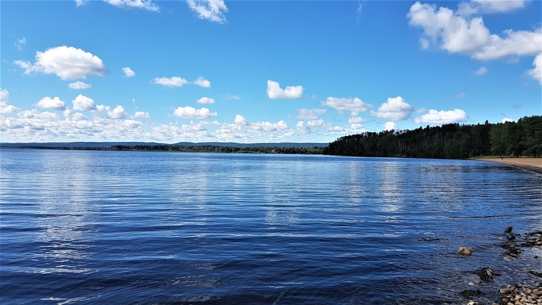
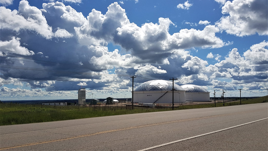
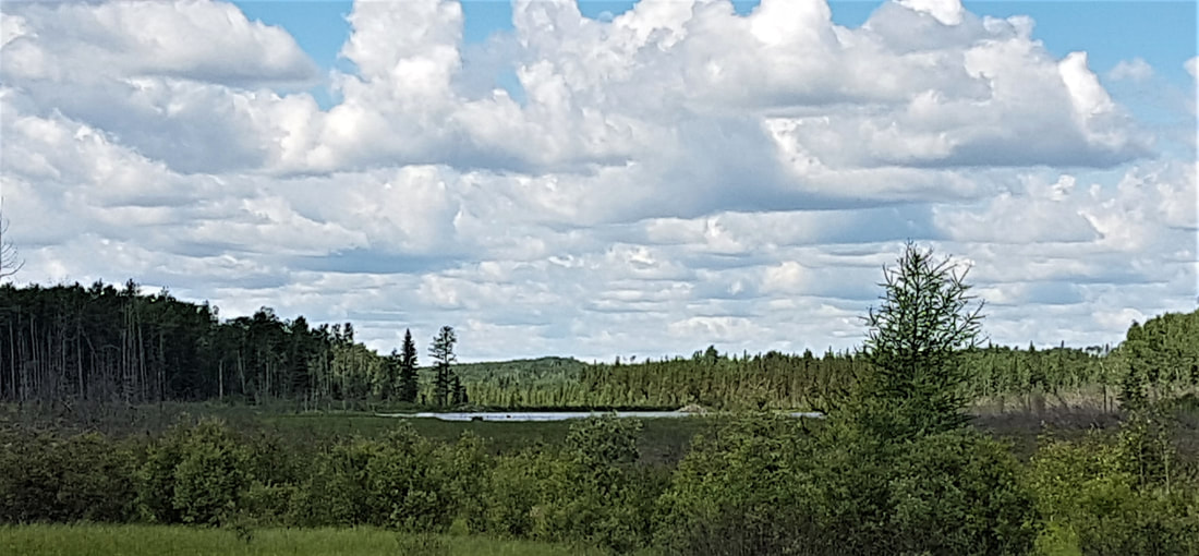
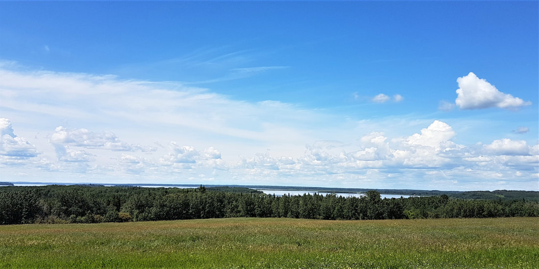
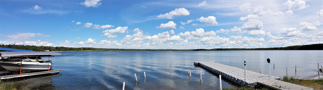
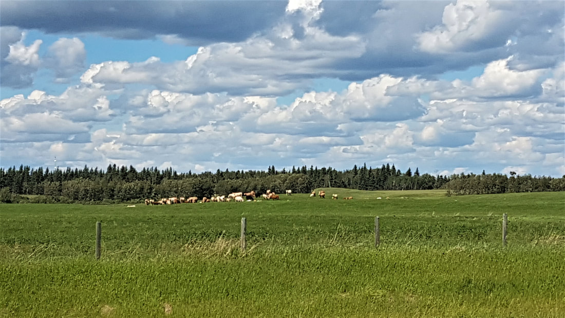
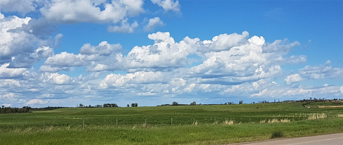
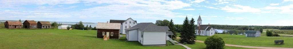
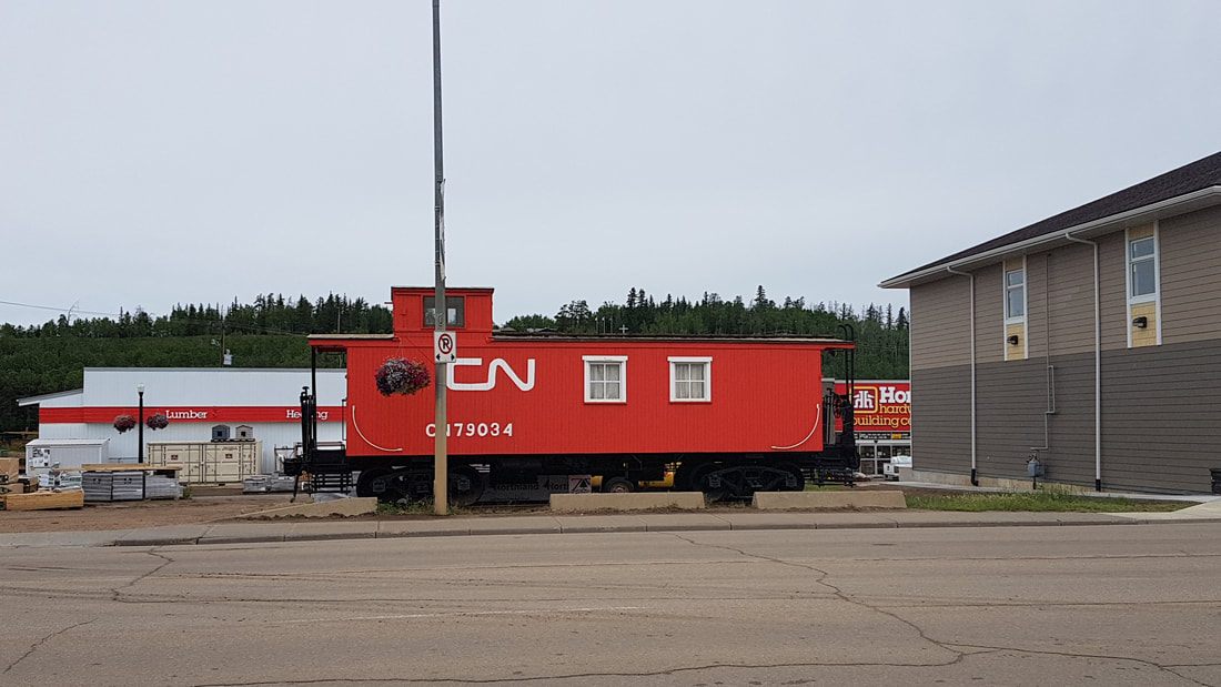
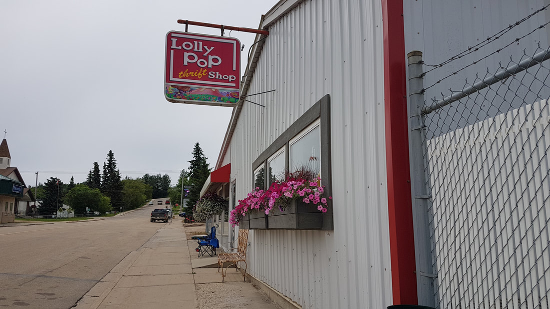
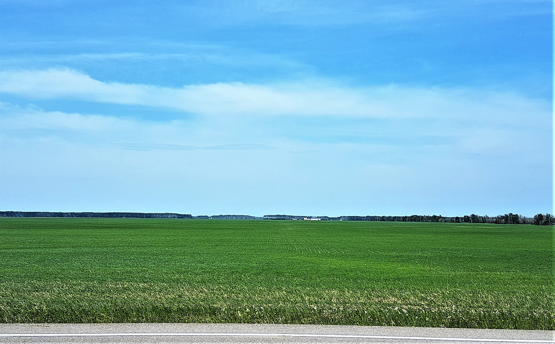
All right folks. Back to serious business here! I’ve been lazy on my rest/visiting days. How are you supposed to learn anything if I’m slacking off?! Having said that – remember to read the Trivia Bits by clicking the button at the top of the screen for your Alberta history lesson. 😊 Fort McMurray is one of many “Fort thises and Fort thats” in northern Alberta. As with so many other communities in the northern reaches of Canada, Fort McMurray got on the map as a trading post in the late 18th century. What later became known as the Athabasca oil sands were known by the local Cree long before the Europeans arrived, as they used the surface deposits to seal their canoes. In the 1790s, the first recorded description of the oil sands was made by…….wait for it…….Alexander McKenzie!! That boy got around! Oil, however, didn’t become a big deal until the early 20th century, and even then, Fort McMurray remained a small centre as it was a few decades before anyone figured out how to successfully extract it. Between 1967 and 1979, several oil sands plants had opened up and Fort McMurray boomed. The rest, of course, is history. It has been boom and bust ever since, but is still in operation and sustaining a sizeable population. I left Fort McMurray and the Morgan home this morning in decent time and headed south, taking Hwy 881 for a change from Hwy 63 I had taken on the way up. Not too long after the turn-off, I saw signs for Gregoire Lake Provincial Park and determined to stop there. Despite having seen the sign, I rode by the turnoff and thought “oh well, there will be other places”. But those pesky voices in my head were telling me to turn around and go back. So I did. In spite of the fire that has marred its edges, Gregoire Lake is a large, beautiful lake. It was peaceful and serene in the morning light and I thought that Tracey ought to share that with me. So I got off the bike and listened to the birds and enjoyed the beauty of it and left some ashes there to float away on the water. Again, the feeling of lightness of spirit found and stayed with me. As it turned out, it was a good thing I did stop there. There were many pretty little scenes along the road, but the side roads were dirt – soft and muddy from the past few days’ rain. Rest stops were not placed at points of prettiness and shoulders were narrow and crowned, so there was little opportunity to pull over and take photos or enjoy scenes other than to take them in as I rode by. The landscape was marshy and boggy, with a proliferation of varied trees and shrubs. It smelled spicy and pungent and lush – like earth that is alive with life. And so it was. The day was perfect for riding. Sun and cloud with temperatures in the low-20s. The sky tried to convince us that we were headed for a thunderstorm, but Fury and I scoffed, knowing that it was only gathering and would not get us. Since there were fewer photo indulgences, we made good time to Lac La Biche. Lac La Biche Mission is a National Historic Site. It is another mission that was started by the Oblate Missionaries, who have also been showing up all over the north since my journey began. You read about them in a previous story – the French missionaries that took a vow of poverty and then came to North America to spread their religion. We stopped for gas and had a chicken wrap at Joe’s Grill, which was very good! With about 3 hours to go to Meadow Lake, SK, I jumped back on the bike and off we went. Travelling west towards Cold Lake, we rode through some low rolling hills and the landscape gave way to crops and cattle. The crops are well up and the scenery was beautiful. This area of Alberta is littered with lakes – there were signs pointing this way and that, stating distances to lakes all over the place. Sometimes 3 or 4 per sign! I think a person could spend a whole summer dragging a camper around to all of them if one was so inclined. Arriving in Cold Lake about 3:30 p.m., I was surprised to see it was much bigger than I expected, with a population of almost 15,000 at the 2016 Census. I wondered what went on there until I saw the military planes. There is a significant military base at Cold Lake. According to Wikipedia (so it must be true), "Every year Cold Lake hosts military forces from around the world for Exercise Maple Flag, a training exercise where pilots and support staff of NATO allies can take advantage of the Air Weapons Range and relatively open rural air space." Cold Lake also supports the oil and gas projects in the oil sands and may even see production of it in their own region. As for me, I topped Fury up with gas and had an iced lemonade at the Tim’s before heading back out. The temperature had risen several degrees so it was also a chance to shed my jacket liner. My impeccable sense of direction took me left instead of right upon leaving the gas station and I discovered the road ended at a provincial park. The park was lovely, so we cruised around it pretending we were there on purpose, before heading back out and getting back on the right road. Sheesh! Did I roll my eyes out loud? I was disappointed to cross the Saskatchewan border and not get a “Welcome to Saskatchewan” sign to take a picture with. Just a small “Saskatchewan, Naturally” road sign greeted me – if I’d have blinked, I would never have known I crossed the border. I guess I wasn’t on a major enough highway for the big one. The last couple of hours to Meadow Lake were very pretty, traffic was light and we just sat back and enjoyed the ride. Knowing the rain we skirted today is coming, I topped up with gas again so there’s a full tank and checked into a hotel. Unloaded Fury and walked to the nearby Superstore for some nibbles for supper so I don’t have to go out again. Veggies and dip, yogurt and a mango for supper this evening, followed by a hot bath! Time to get myself to bed and see what mother nature brings us tomorrow! While my time in Alberta has been focussed on the unsung north (I've been across the central and southern regions a hundred times), there is so much to see and do in Alberta. Dinosaurs and hoodoos, stampedes, the natural wonders of the Rocky Mountains, Waterton Lakes National Park, Red Rock Coulee, and on and on. Check out Alberta Tourism if you are planning a visit.
6 Comments
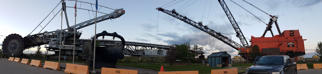
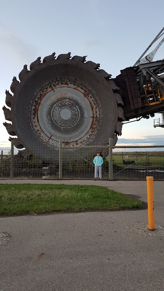
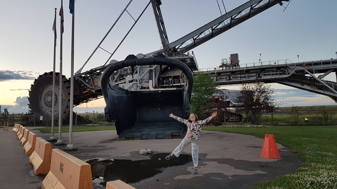
After an extra day of rest, I'm headed for Saskatchewan. Yesterday was a chill day. Grace and I scooted out for breakfast and then found a soap kit to keep us busy for the rest of the morning. Did some laundry and assembled all my stuff. In the evening we all went for a drive up to the oil sands, which was interesting to see. The camps are quite impressive and the operations are massive. The sun is shining today and I'm looking forward to a nice ride! Just a quiet day visiting and resting. Little bit of work, a massage and a nap! Felt pretty fuzzy after my massage - clearly something I will need to keep doing as I go! Tomorrow will be time to start assembling gear and getting prepared to head out again. Stay tuned for more adventures!
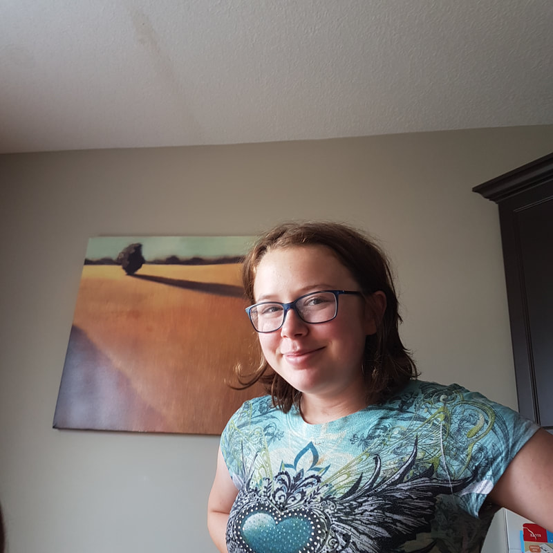
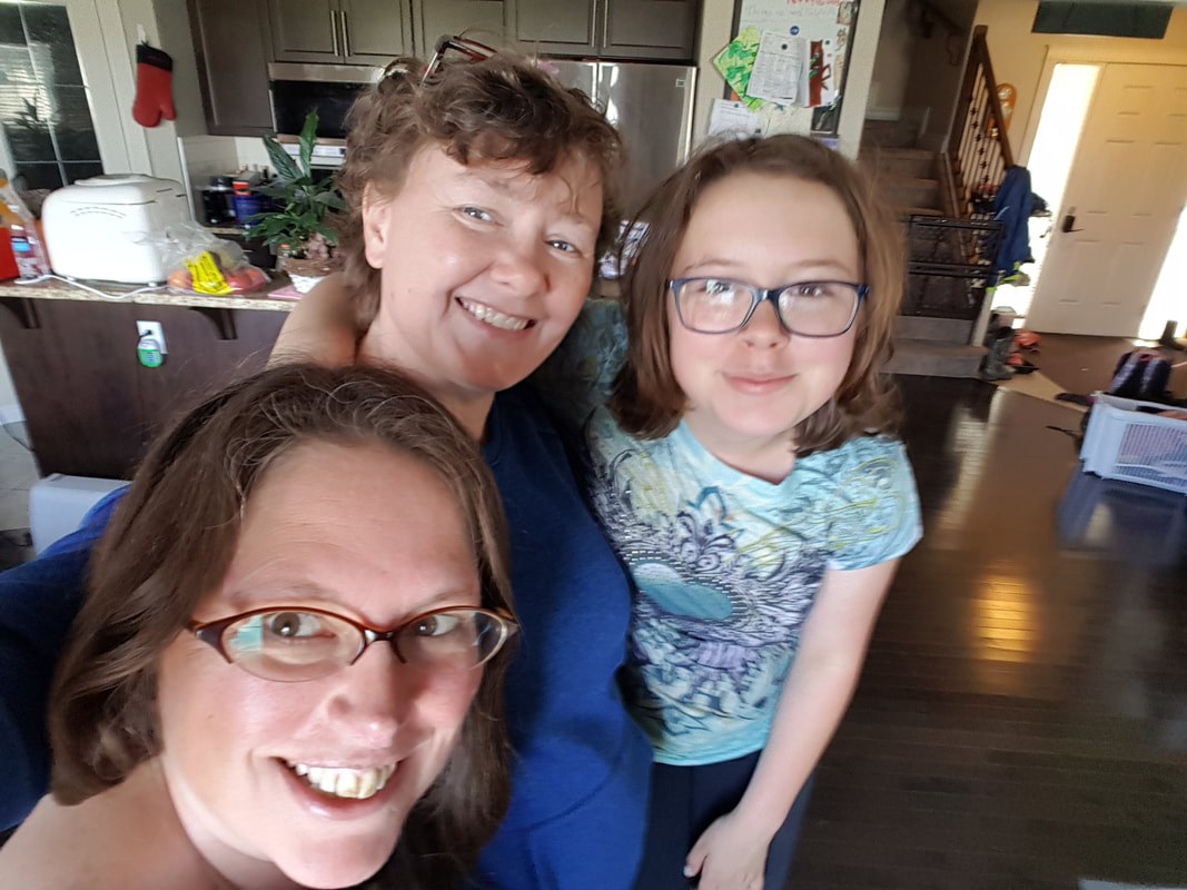
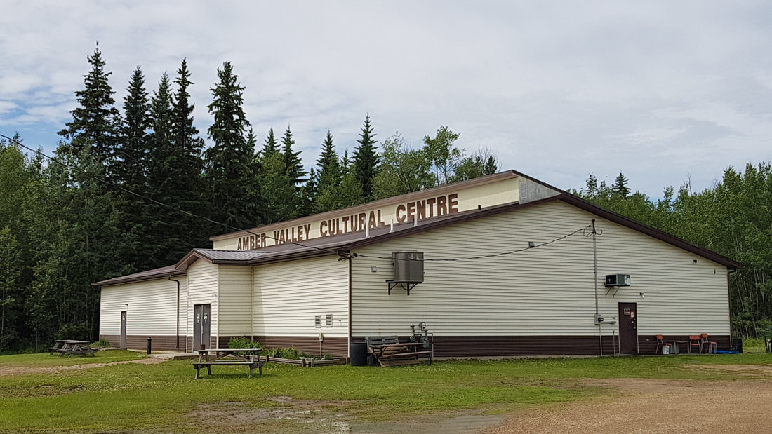
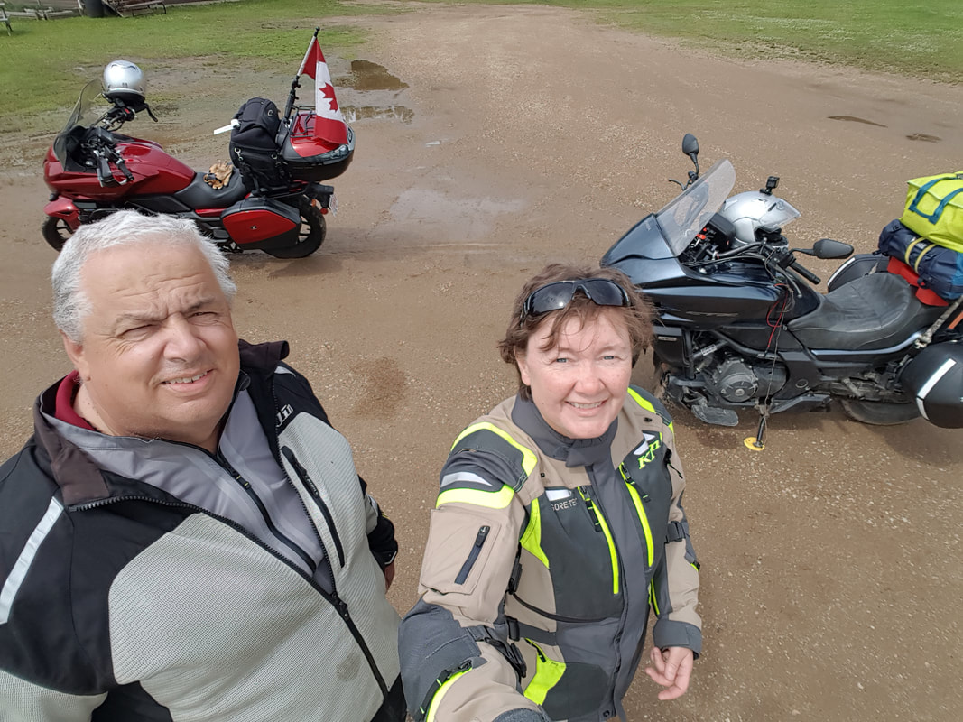
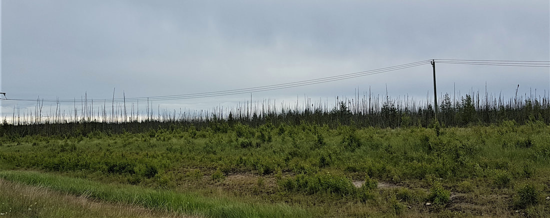
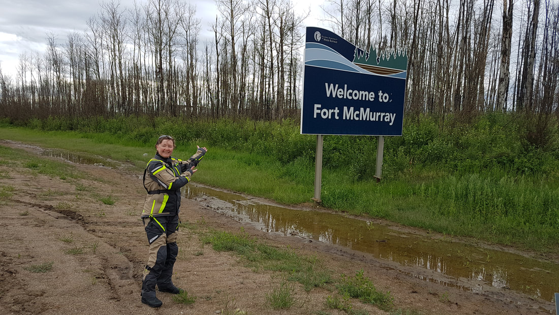
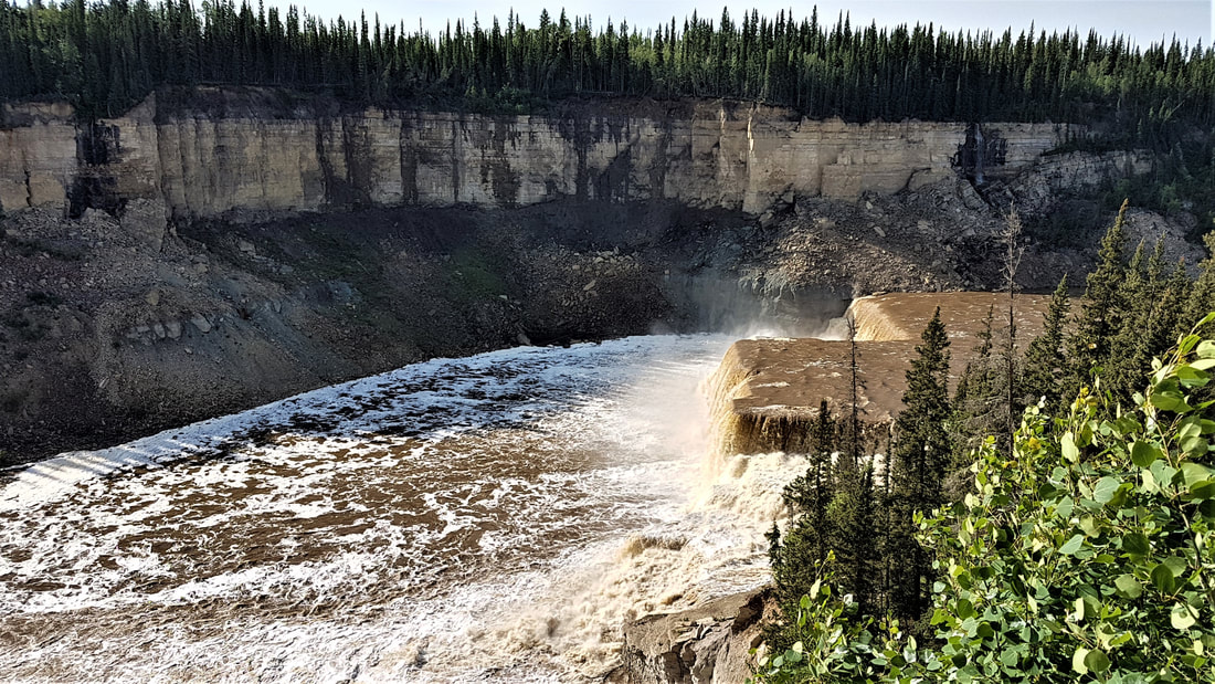
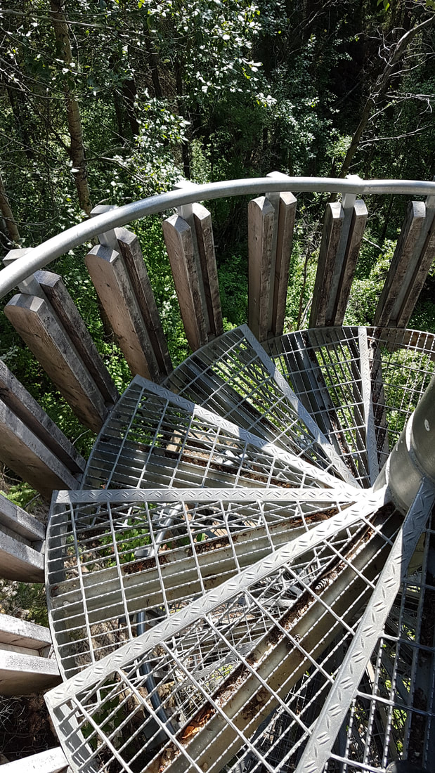
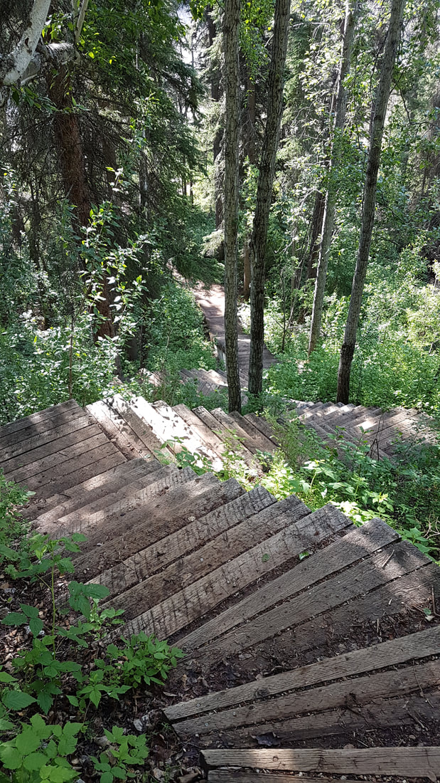
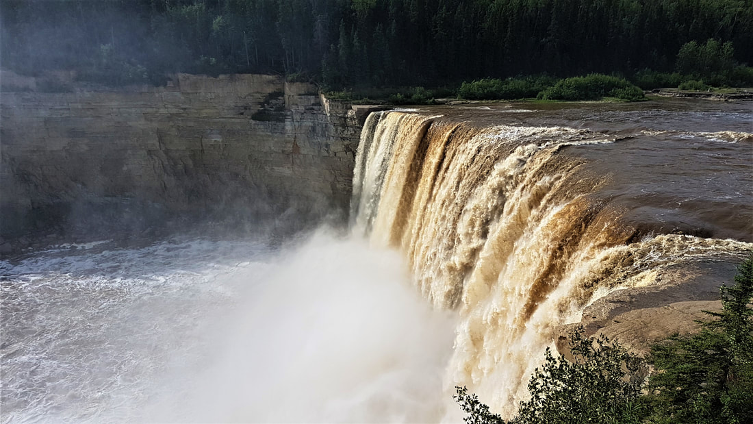
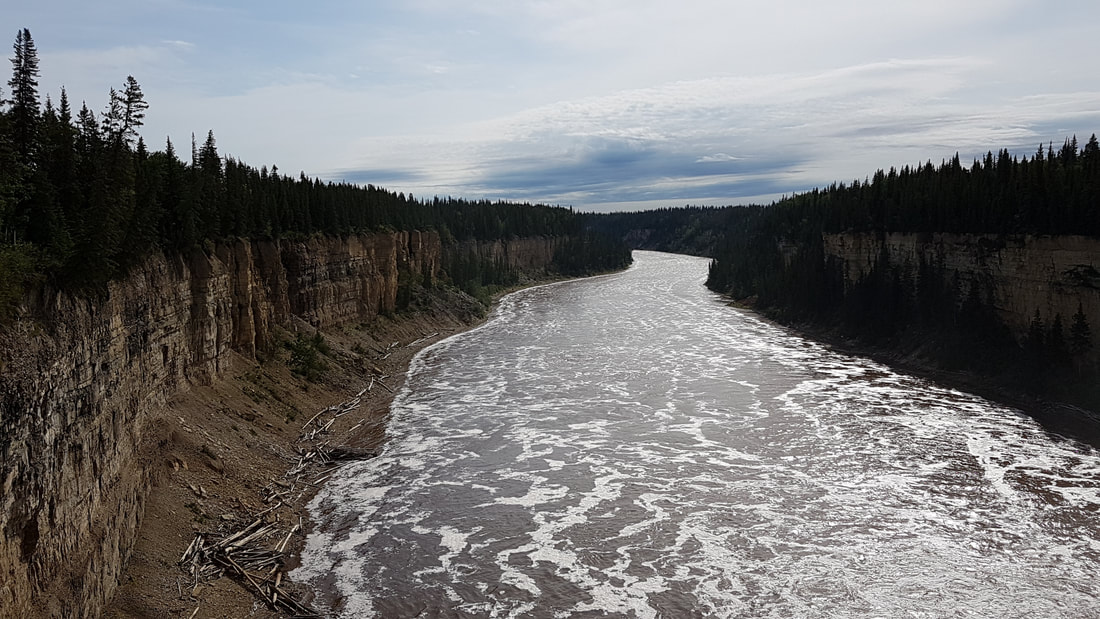
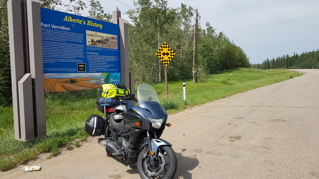
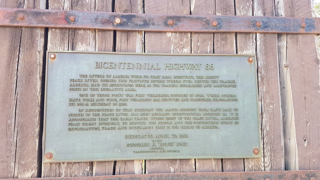
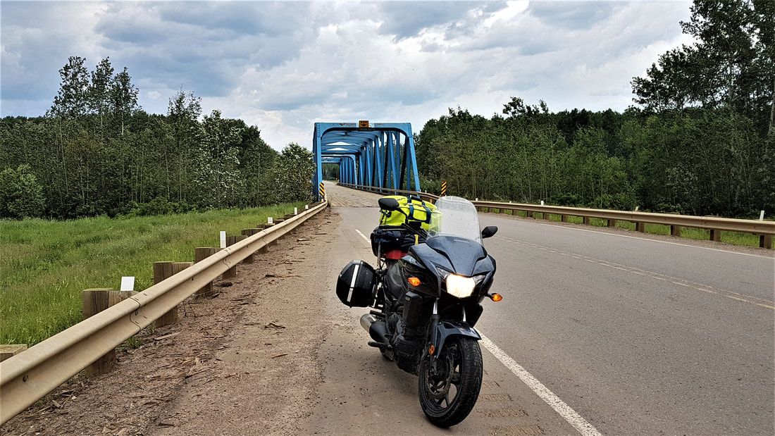
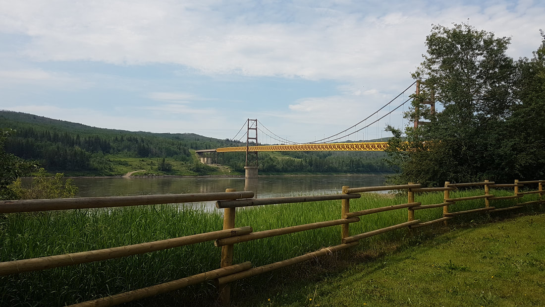
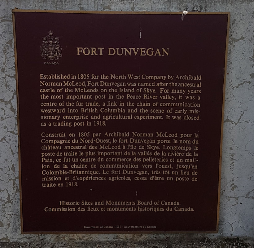
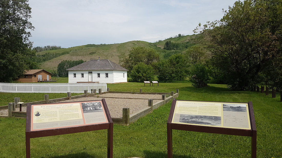
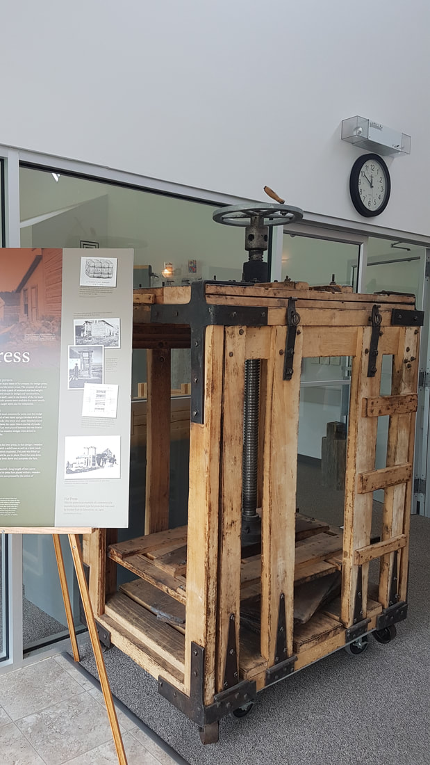
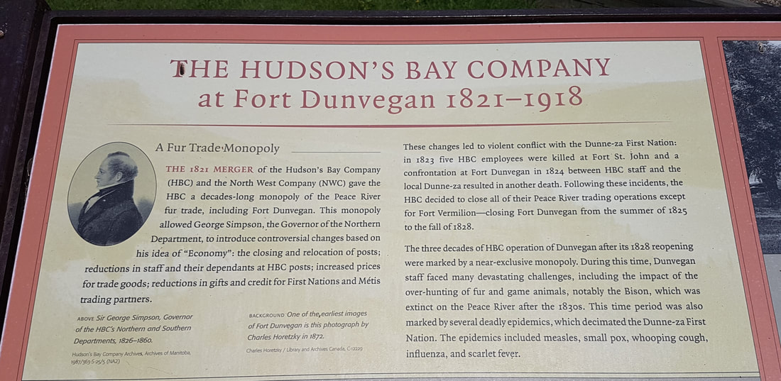
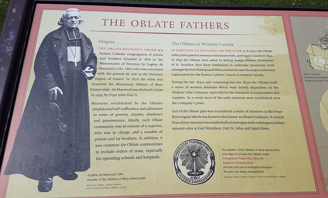
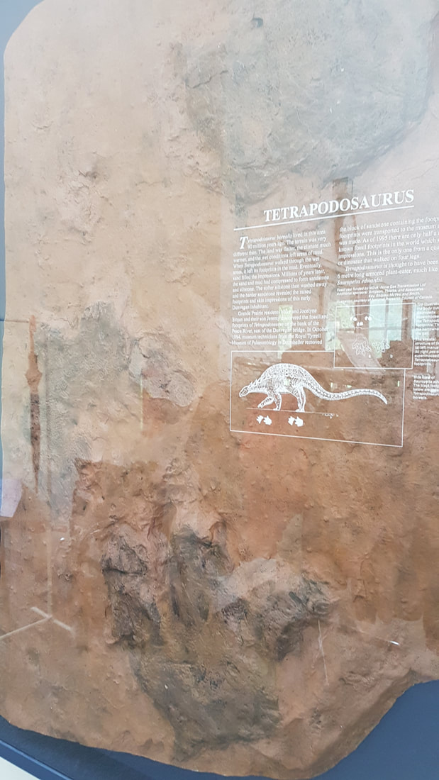
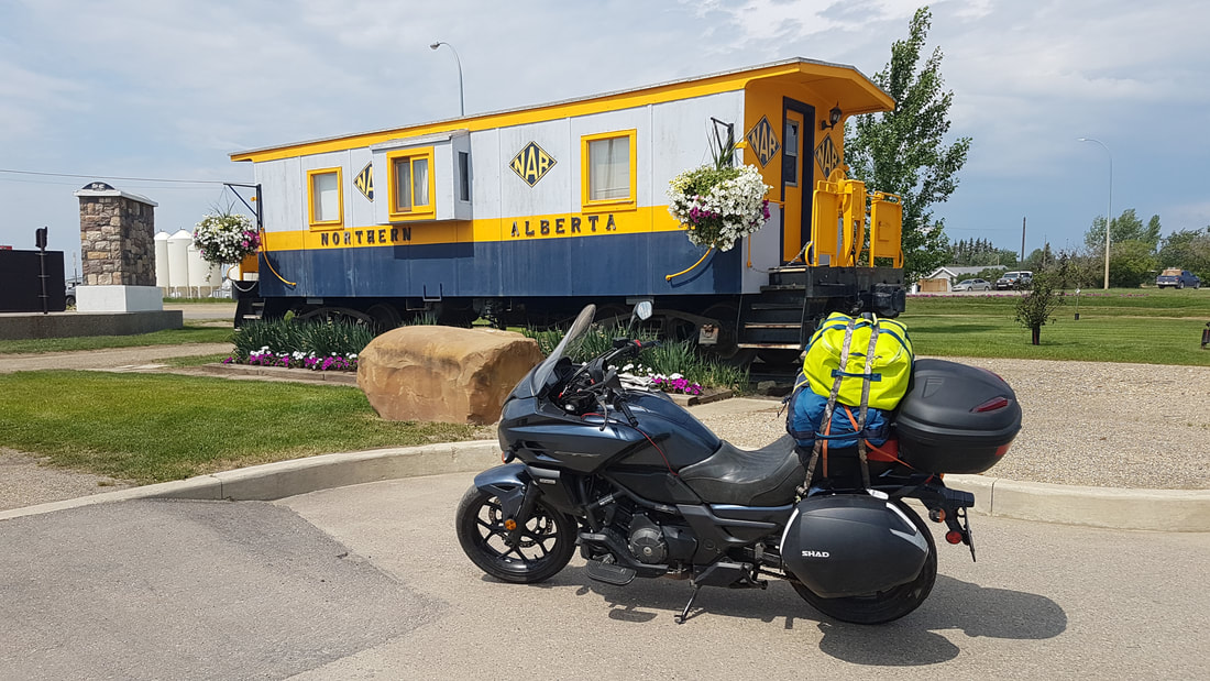
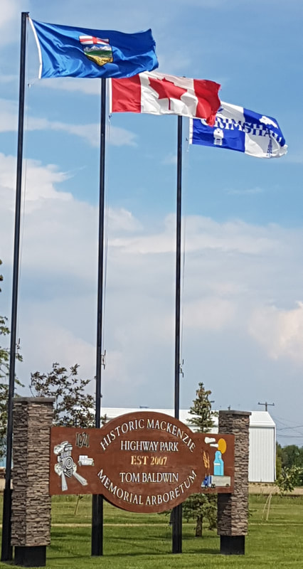
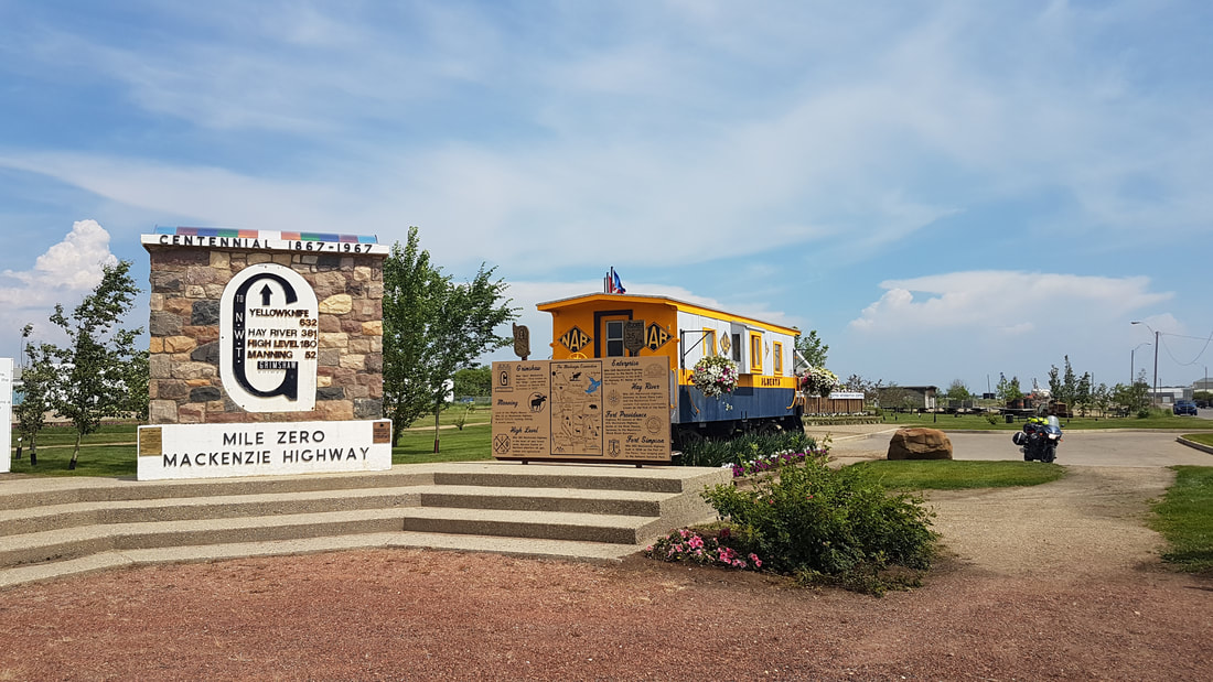
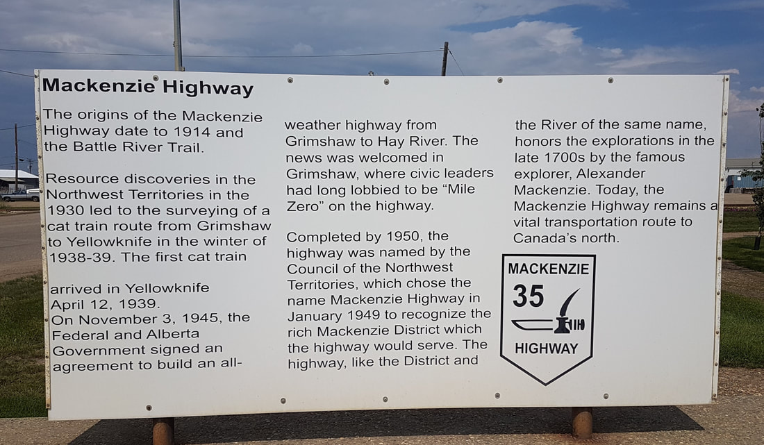
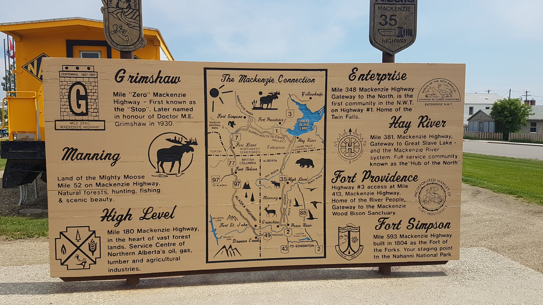
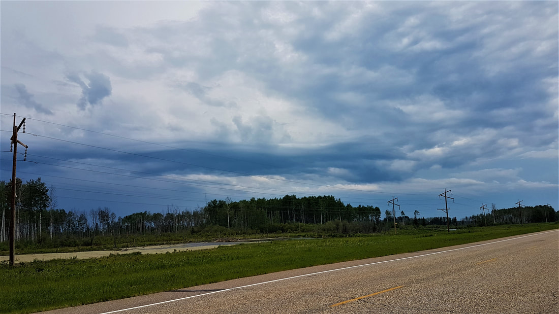
Just a chill day with family. Slept in a bit and planned to get out and clean up the bike, which did eventually happen. Steve helped me out with checking my front sprocket, which meant taking some things apart that I wasn't comfortable doing on my own. Got the bike washed up and a bunch of crud out of the crevices. Getting done with that job, Margaret and I went out for lunch and then did some strolling around some stores. We convinced ourselves we should buy a cheesecake for desert and stopped at the Superstore on our meanderings. The evening was spent having dinner and visiting, including a game of mousetrap with Grace that I'm not sure we quite played by the rules, but had fun. Having consumed cheesecake and tea, it is now time for bed!  Today’s ride took me from Slave Lake to Fort McMurray. The ride from Slave Lake to Athabasca was nice. Little traffic, and despite some construction on Hwy 2 east, it was pleasant and pretty. Definitely cattle and crop country! The first cut of hay is coming off and the ride was fragrant with it. Glenn, who rides the same bike as me (except it’s red), met me at Athabasca and we had breakfast at the Grand Union Hotel. He lives in Fort McMurray, so had picked up his bike in Edmonton and joined me for the ride. Our next goal was to find the Amber Valley Museum, but after some asking around and searching, we never did find it and determined that it didn’t exist. There is a lovely waterfront park at Athabasca with some great story boards about the area. Athabasca Landing began to boom in the early 1900s with the influx of settlers brought by the railway. It boomed for 7 or 8 years before a fire destroyed a good portion of the community. With the news that new railway lines to Peace River and Fort McMurray would by-pass Athabasca, many business owners did not bother to rebuild, and left the area. The community of Amber Valley itself, was settled by 170 Black settlers that came from Oklahoma in the early 1900s. Today, there is nothing left of the original community except a cultural centre, homestead and cemetery. The cultural centre is only available for tour by appointment, so we rode in, but were unable to see it. Getting back on the highway, we headed for Wandering River where we stopped and topped up with gas and a “Coke break”, before continuing to Fort McMurray. It had begun to rain when we were in the restaurant, and Glenn said to me “Did you do this? You know I’m only here to do this ride with you?!”. I said “There’s no such thing as bad weather – only experience! Besides, that rain isn’t going to last long – it’s just pretending”. So he put on his rain gear and off we went. The rain really didn’t last very long and the rest of the ride was chilly, but dry. The green vibrancy of the landscape was enhanced by the clouds scudding across the sky as we rode and the air was fresh and clean. Within an hour of Fort McMurray, I began to see the damage from the fires that swept through a couple of years ago and thought of the highway being plugged with crawling vehicles trying to get to safety. Shivers.. Stopped at the sign to prove I had made it to Fort McMurray and arrived at Alexis and Steve’s about 6:30 p.m. Fed and watered, I have had a visit with Margaret and Grace, a flowered-deck tour, read a bedtime story and remembered to do my blog. I am looking forward to a couple of days of rest and visiting. Today’s objective was Hay River, NT to Peace River, Alberta. Checking out distances and weather, I knew that I was likely to hit thunderstorms a couple of hours out of Peace River, but I could always hole up in Manning if that materialized. I left Hay River in good time and had a very enjoyable ride to Enterprise and the border. Knowing where my phone was this time for pictures, I stopped at Louise Falls on the way out. Different again from the other waterfalls, it is a thundering one! If you walk up the trail a little further, there is a steel spiral staircase and a bunch of wooden stairs leading down to the top of the falls. There are 44 steel stairs and 96 wooden ones, to be precise. So if you want your morning exercise, jog those a couple of times! The trail actually continues on and goes all the way to Alexandra Falls, which is 2 kms by trail and 3 kms by highway. Feeling that I needed to get back on the road, I scooted back up the stairs and took the highway to stop at Alexandra Falls as well. I did not see ONE bison the whole time I was in the Northwest Territories, despite being warned by everyone I saw about them being all over the roads! Good thing I saw some at Liard River Hot Springs or I would have been very disappointed. It was a lovely ride out with a nice tail wind and I made it the whole distance from Hay River to High level on one tank of gas. When I filled up, it only took 10.35 litres, which meant I still had 70-75 kms left in the tank! Granted, I also kept my speed down as a test. Stopped at the A & W in High Level for a quick lunch and a guy there asked where I was off to. Told him I was planning to make Peace River before heading east on the northern road to Amber Valley tomorrow. He said “We’ve got a short cut to Slave Lake” and told me I could go to the Fort Vermillion turnoff, then head south to Red Earth and Slave Lake along Hwy 88. I quizzed him about time and distances and he said “about 4 hours to Slave Lake and there’s gas at Red Earth, which is about 250 kms from High Level”. Since I knew it was 3 hours to Peace River with the last 2 probably being through rain, it sounded perfectly reasonable to spend another hour on the road and get as far as Slave Lake. Moreover, the thunderstorms were supposed to be east of that area. So what the heck - off I go on this alternative route! Note to self: If you take travel advice from people, confirm it before taking it. It is not 400 kms or 4 hours to Slave Lake – it is 484 kms (5 hours). More importantly, gas at Red Earth is not 250 kms away – it is 310! This is a significant difference when you decide you are going to book it down the highway and then see the sign that informs you there is a lot further to go on that tank than you thought. Soon after I got on the road, the winds shifted from a tail wind to a head wind. Still not bad – better than a cross wind. No sooner had the thought crossed my mind, it changed again to come strong from the east while we were travelling south. Fury pushed back and we kept on. Shortly after that, the temperature dropped about 10 degrees (I was dressed for the earlier heat) and I could smell the rain coming. Lightning began to the east and seeing the storm ahead, I knew we weren’t getting out of this one! I also knew that the chances of getting into Red Earth on the tank of gas I had were slim, but I might make it on fumes if I brought my speed down to 75-80 km/hr. I did have spare fuel, but by this time the rain was pouring down and I was cold, so the idea of unpacking the bike to get to the fuel pack and filling up in the pouring rain was a last resort. Not only that, but there is NUTHIN’ for great distances along that road, so there was no option to safely pull over to do that job. So we travelled along at 75-80 with the hazard lights on through the rain for about an hour and a half. Suddenly, the rain let up and the sky brightened and there was a pull-out ahead! Being pretty cold by now and wanting to get to Red Earth for gas, I pulled over, unpacked the bike and fed Fury the rest of my spare fuel. The skies continued to lighten and the rain stopped and we made tracks for Red Earth. Not having any idea what size of community Red Earth was, I pulled into the first gas station I saw, after casting a very dubious eye over the muddy path to the pumps. I thought I could see a relatively firm path through it, but partway in, a soft patch grabbed the tire and I thought for sure we were going to get a bath in the huge puddle beside us. Miraculously, we pulled out of it and stayed upright. Whether that was instinct or luck, I couldn’t tell you, but I found a different path out! Back on the highway out of Red Earth, there were 3 other gas stations with much better accesses. I would have been pretty choked with myself if we had gone down in the mud and I had seen those after. Chilled, but stubbornly insisting on finishing the last 160 kms, we got back on the highway, took some time to work the mud off the wheels and then booked it to Slave Lake. Arrived tired and cold at 8:30 and went straight into a hot bath! Looking at the map, I realize that I am within an easy day’s ride of Fort McMurray! I suppose I should message cousin Alexis and let her know that I am a day earlier than the day early I told her I would be yesterday…. 😊 Tomorrow, I will be joined in Athabasca by a CTX700 forum friend that, of course, has the same bike as me. He lives in Fort McMurray so we will have a CTX ride for a couple of hours. I hope he can keep up since I have the faster colour…. Welcome to Alberta……and the prairie wind, which never seems to be going the same direction you are! I actually arrived in Grande Prairie, Alberta a couple of days ago, as stated in my post leaving BC. Finding, for the first time, an excellent wifi connection at the Service Plus Inn and Suites in Grande Prairie, I decided to stay an extra day and get some work done. I really liked this hotel. The cheap hotels in Grande Prairie had appalling reviews, so I used one of my hotels.com free nights on this one. Clean, comfortable and spacious, good bed and pillows. And free self-serve breakfast - bacon, sausages, eggs, pancakes, yogurt, bagels, toast, tea, coffee, hot chocolate, juice - you name it! That's worth $20 right there! Grande Prairie itself doesn’t seem to have a whole lot going on. I asked the front desk what there was to do there and the options were shopping, casino or food. There are a couple of nice provincial parks several kms of gravel down this road or that road, but it wasn’t really what I was looking for. It seems that the city is pretty much industrial. It has a lot of construction going on, the usual suspects for big box stores and gas stations, and that’s really all you see coming in and going out. So it was a perfect place to focus on work for a day! When I slipped out for some food in the evening, there were some ladies who were in town from Slave Lake to work at the Casino and raise $$ for their community programs. That brought back memories of working Bingo for Big Brothers/Big Sisters! We had a fun time chatting and laughing before they had to go off to attend to their duties. Headed out a bit later this morning, with the objective of making High Level by the end of the day. Not far out of Grande Prairie was a little town called Sexsmith that I took a quick ride through. There are a couple of similar towns on the way north that have preserved the frontier look on their building facades. Sexsmith was a well-kept little town, but I felt it too early in my trip to be stopping to spend time. The road north took me back into North Peace country. The peace river, not knowing there is a border between BC and Alberta, winds its way through northern Alberta as well. I crossed a really impressive 2375-foot bridge on the way, which was critical a connector between the North Peace and South Peace regions. The suspended bridge deck is 1800 feet! The community of Dunvegan has a great visitor centre and was a hugely important trading post in the Peace River region. It was shut down for a few years due to the HBC achieving monopoly on the fur trade and starting wars with the local tribes by not honouring agreements. It was re-established in 1828 and operated for another 30 years. Dunvegan was also a place where Catholic missionaries came from France to carry religion to the west and start missions in Western Canada. They frequently set up shop close to trading posts as they relied heavily on them for supplies, transport and guides. I stopped at the centre and wandered the grounds at will for about an hour. It is worth a stop to see the church, rectory, and trading post buildings and lots of story boards about the area. The visitor's centre had a fur press, which was something I had not seen before. Furs were packaged for trading using this machine so they could be more easily transported to market. They also had a display of cast dinosaur tracks that had been found in the Peace River valley at Dunvegan – some of very few found with skin imprints. Having just seen the tracks by the river at Tumbler Ridge, it made them seem very real. They were huge! The town of Grimshaw sits at the junction of the highway to Peace River. And guess who shows up again?! Alexander McKenzie - since this is still the Peace River valley for which he is famous for finding the passage to the Pacific Ocean. Grimshaw marks mile zero of the McKenzie Highway to the Northwest Territories. They have a really nice little corner park there and I had to stop and take a photo. Skirting a storm to the west, a bit of it dumped on me just outside of Manning, AB. Mother Nature’s way of reminding me what it felt like to be cold - the temperature dropped about 10 degrees and pelted me with huge drops of rain, soaking my mesh jacket and pants that I had worn for the heat. Seeing the dark clouds swirling around a bit, I stopped at Manning for some lunch at the local Chinese restaurant. Food was great, though I don’t recall the name of it. Not really wanting to stop for the day yet with only 3 hours into a 5-hour riding day, it seemed a good idea to keep an eye on the front and see what it was up to after lunch. The skies brightened to the north, which was the direction I was headed, though things were still a bit ominous to the east and west. I traded out my gear for the waterproof stuff (better late than never) and headed out again. For the first hour or so, the skies stayed light and I patted myself on the back for perseverance. All was good until about half an hour out of High Level. The sky darkened and the thunder rolled and the west winds picked up their pace, trying to throw us around a little more. Lightning began to put on quite a show to the west and that was my cue. With nothing but long, straight road ahead, I laid the throttle down and Fury and I fled for High Level, confident we could outrun that storm. It was absolutely exhilarating to be flying along the road with the blackening sky and smell of the impending rain urging us on. We arrived in High Level with minutes to spare. I checked into a hotel, unloaded my gear, checked over Fury and closed the door. BOOM - the thunder crashed and the skies opened and it poured! And there I was, happily relaxing in a hot bath. I don’t think Fury was jealous – she was getting a much needed bath too and certainly needed to cool down! 😊 On to Hay River tomorrow, so you will see a choronological jump as we move to the Northwest Territories page and then back to Alberta. |


 RSS Feed