|
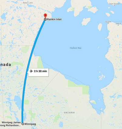
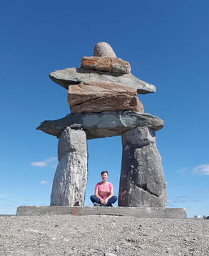
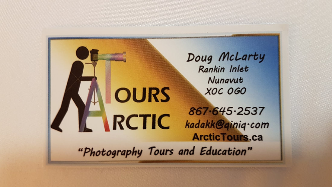
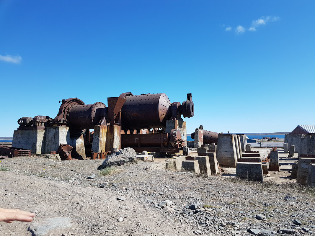
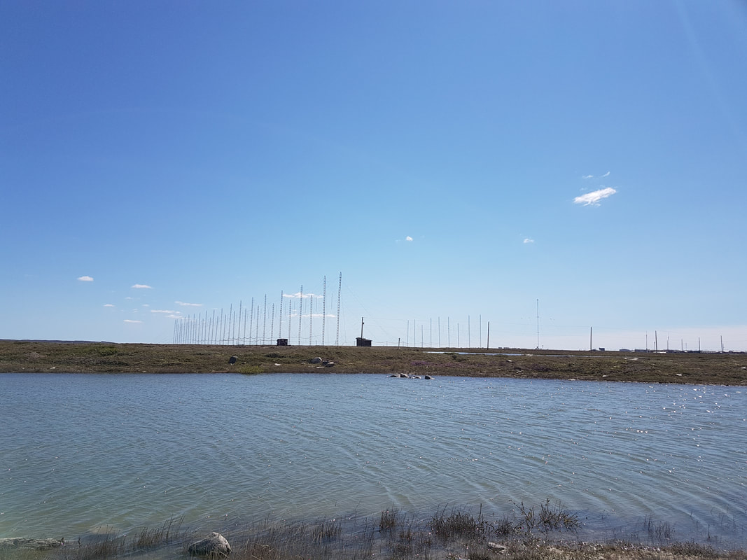
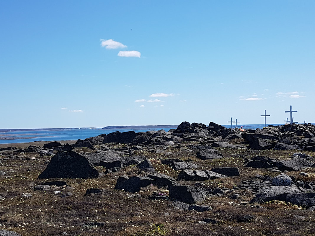
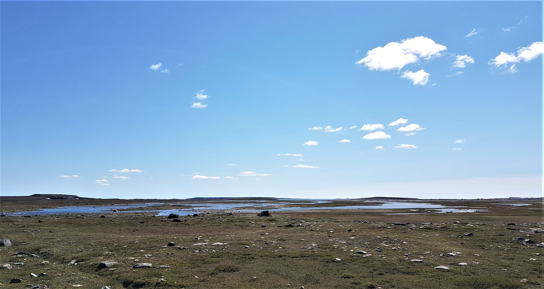
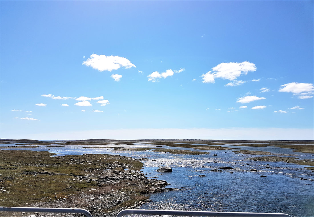
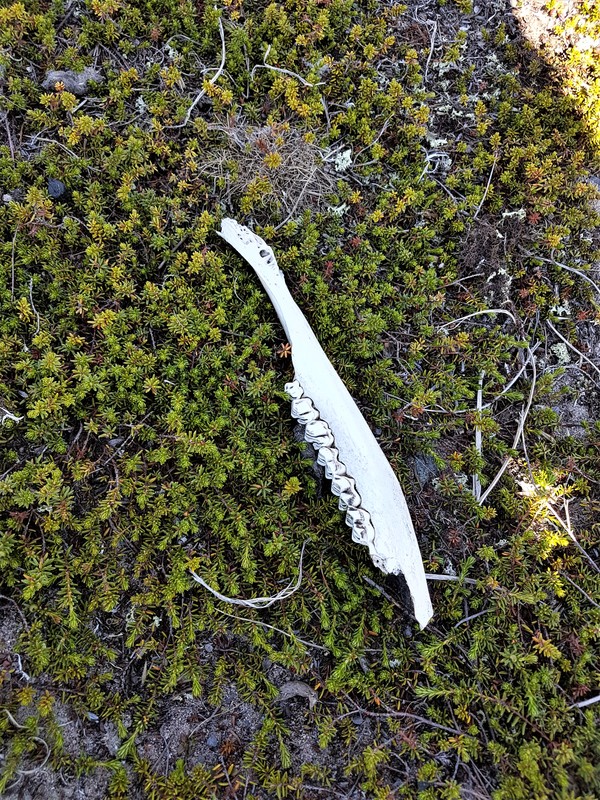
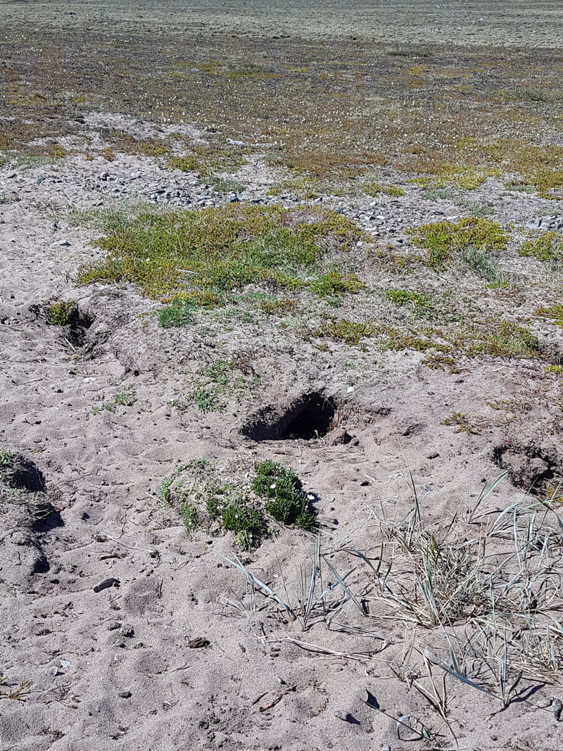
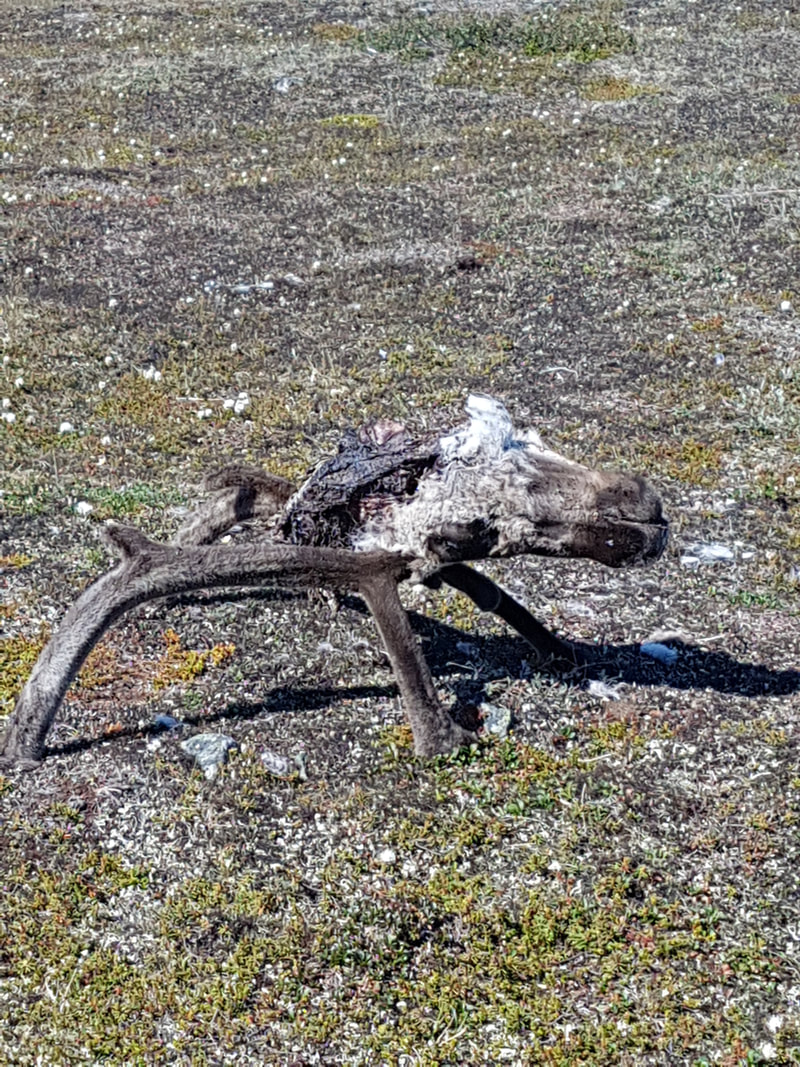
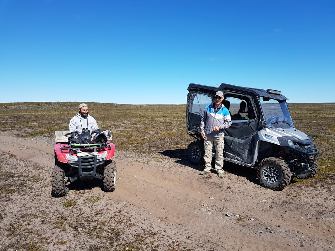
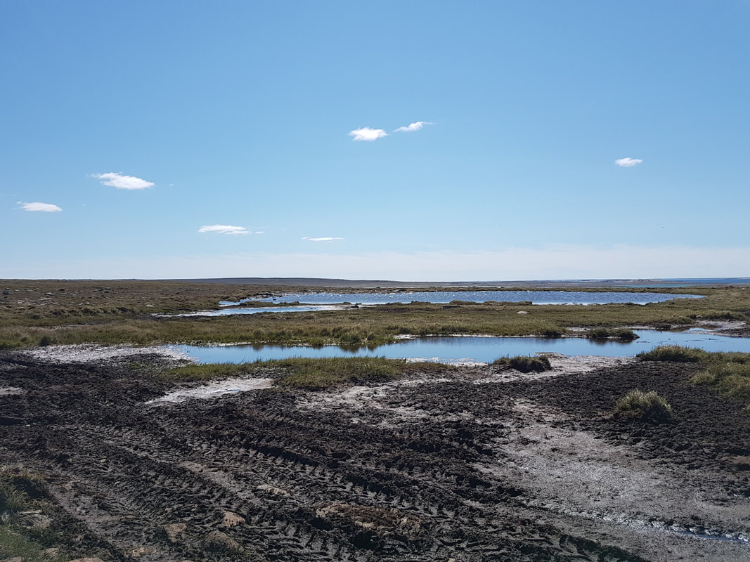
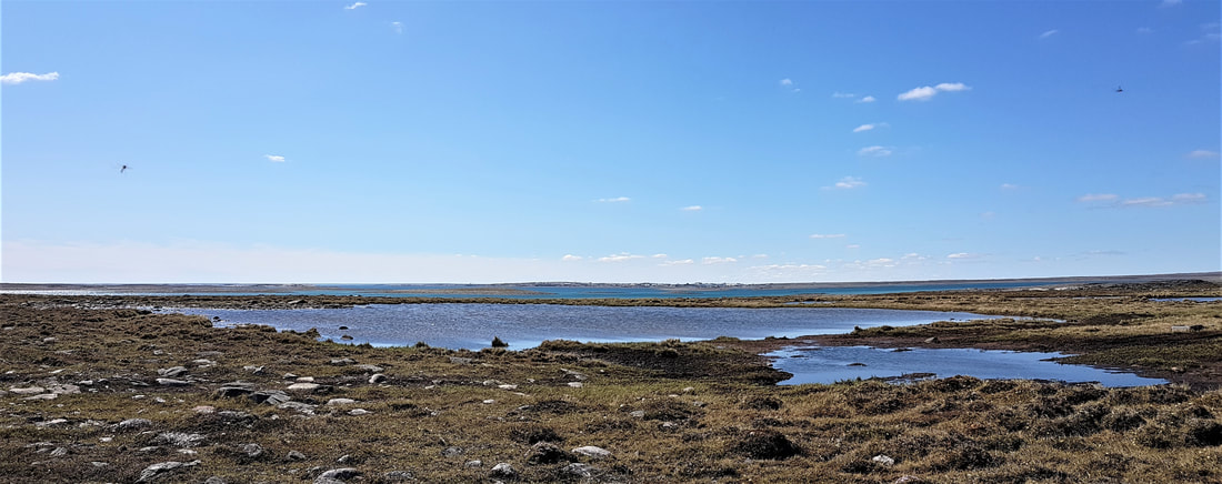
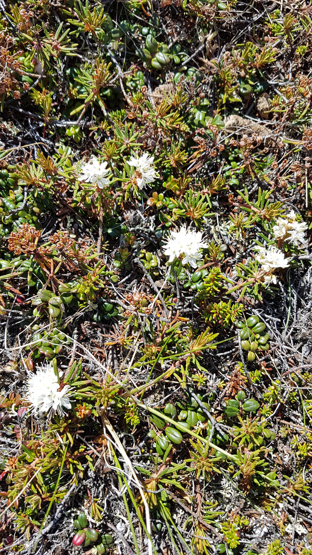
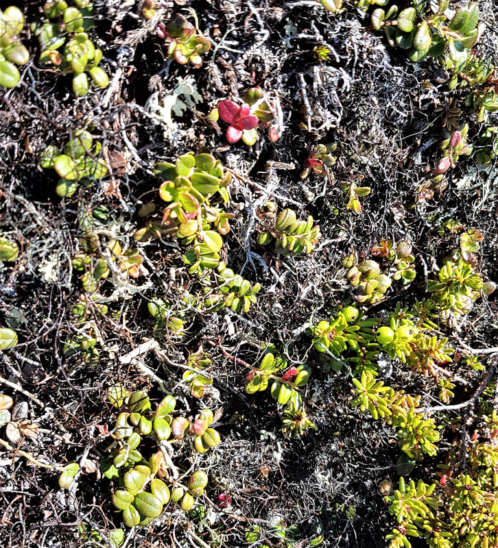
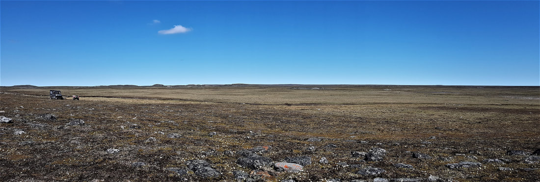
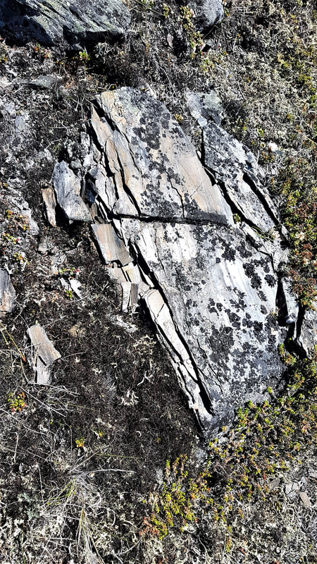
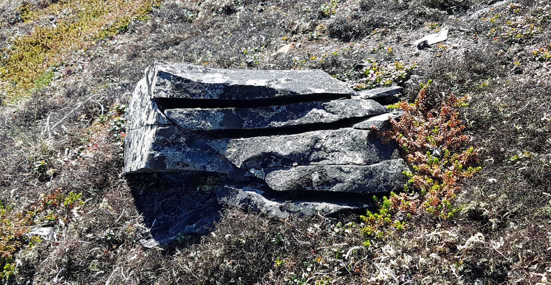
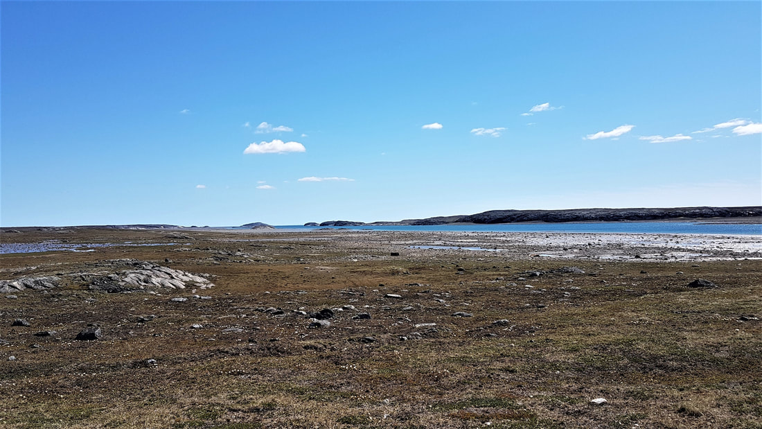
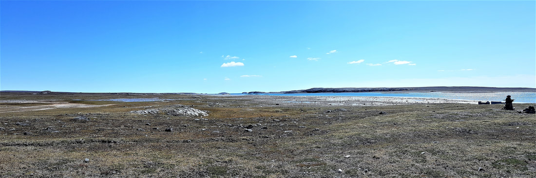
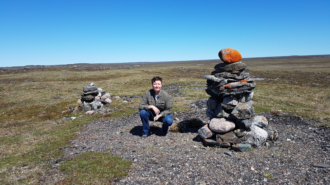
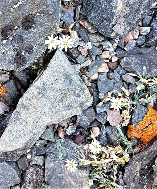
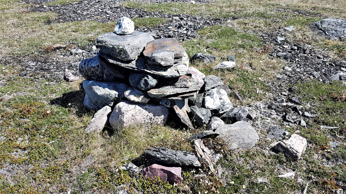
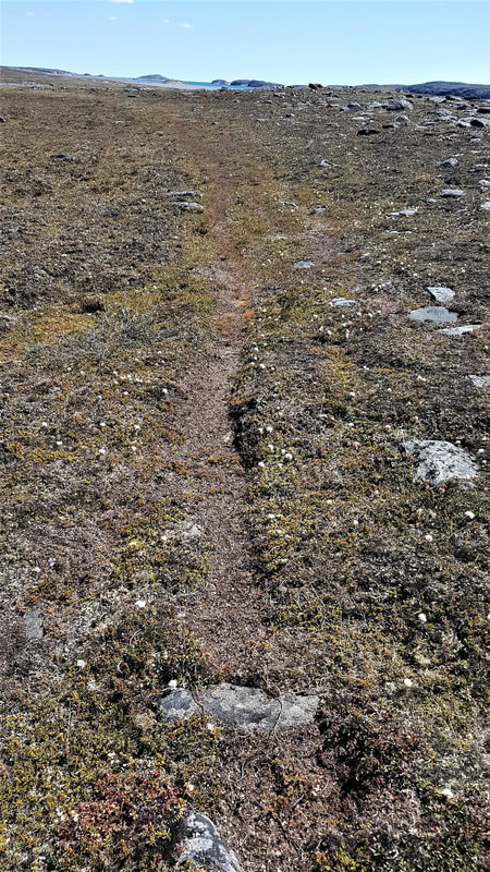
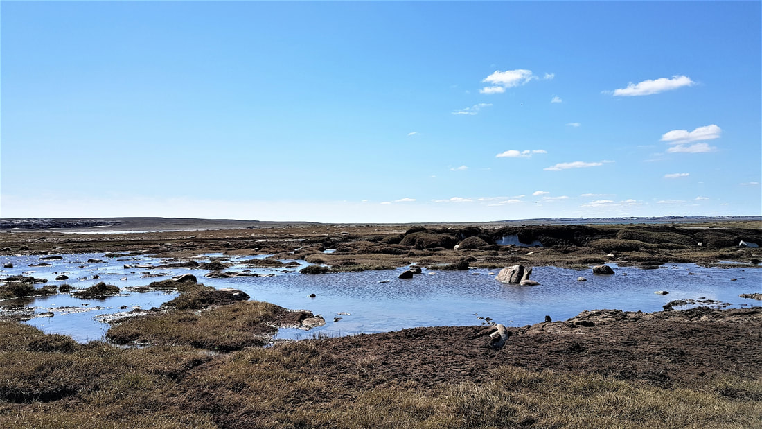
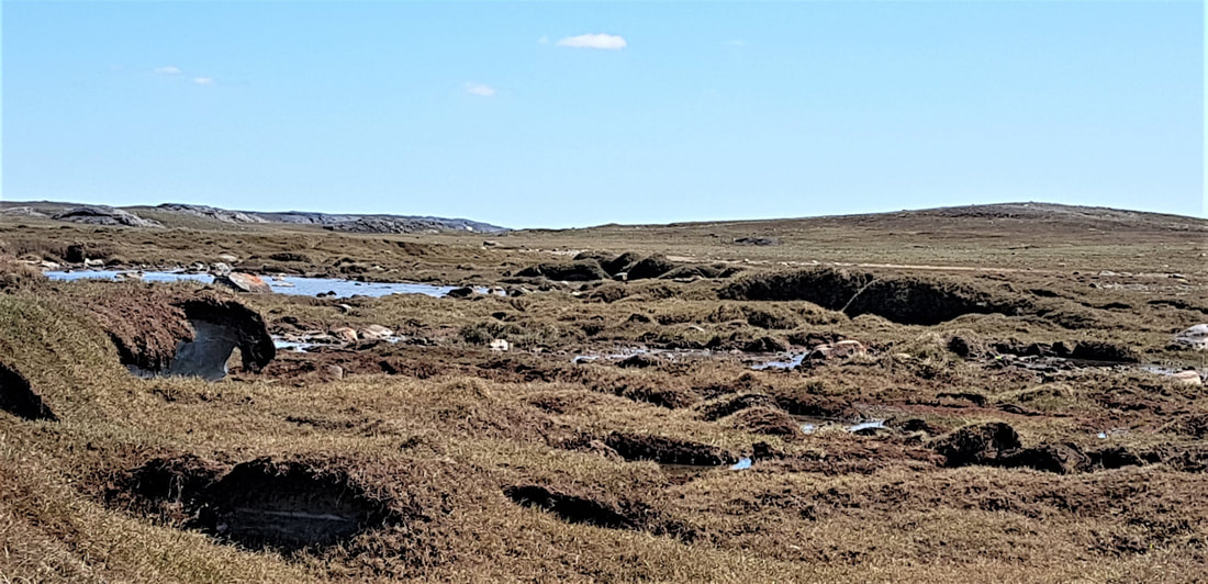
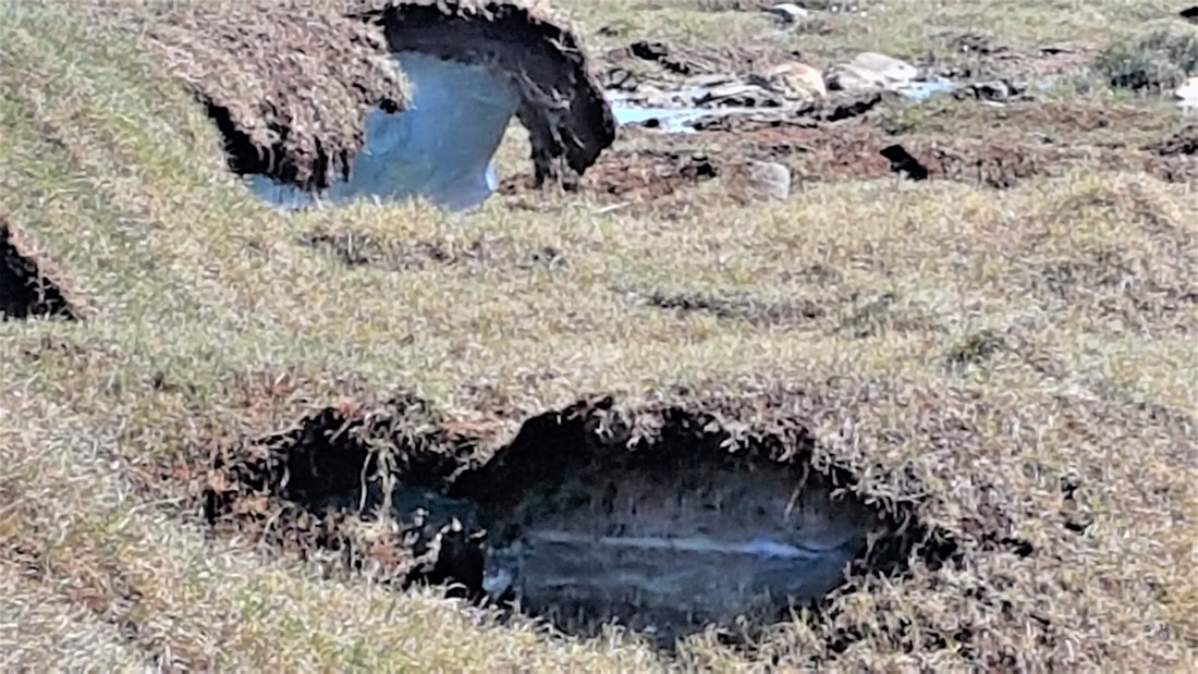
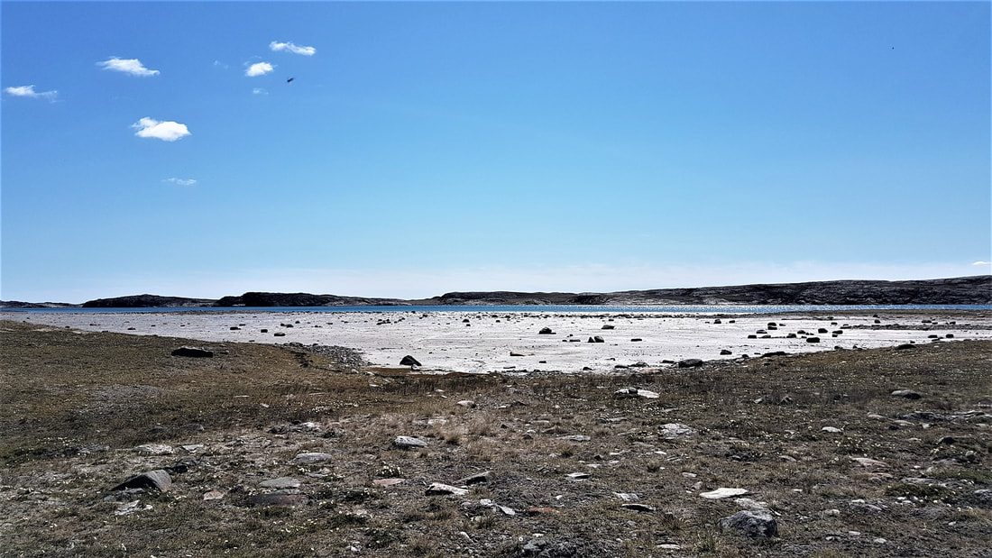
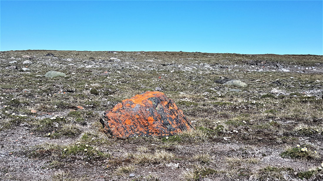
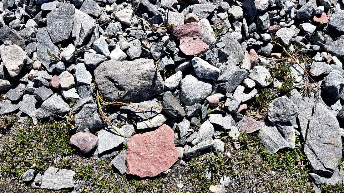
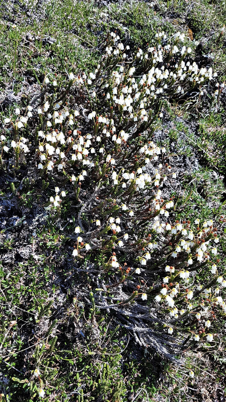
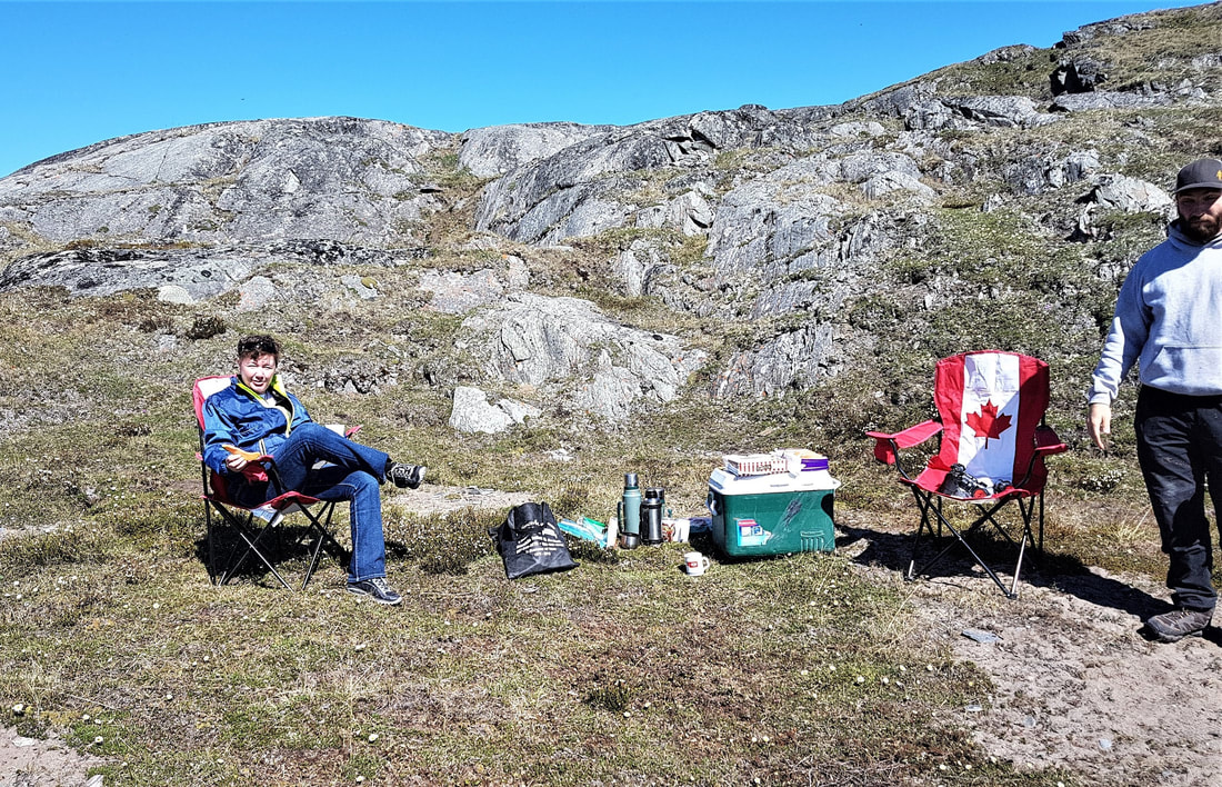
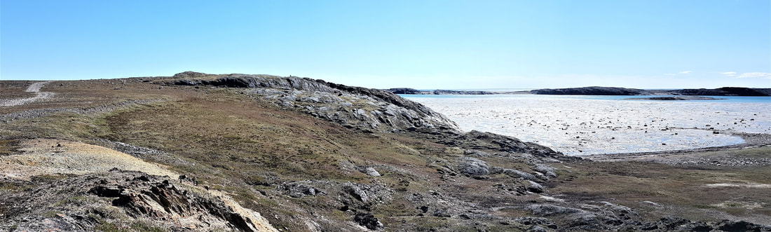
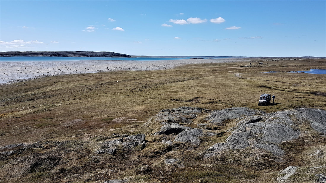
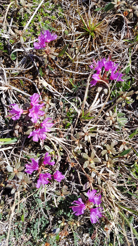
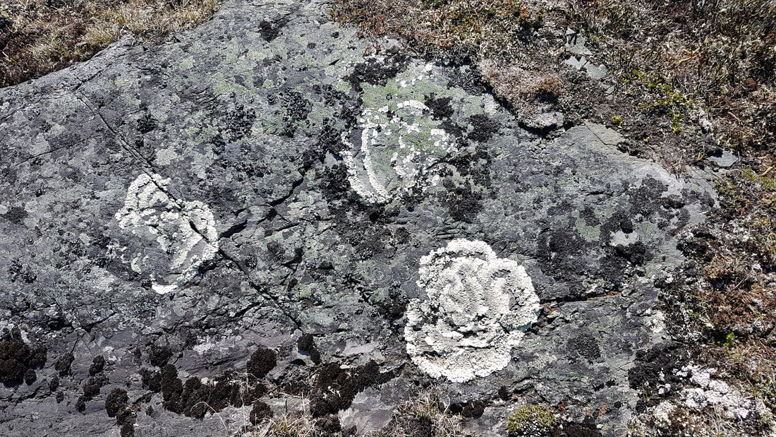
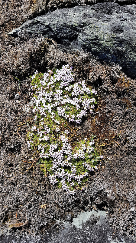
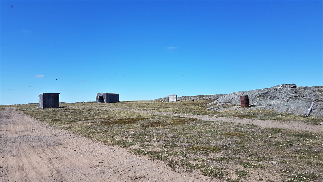
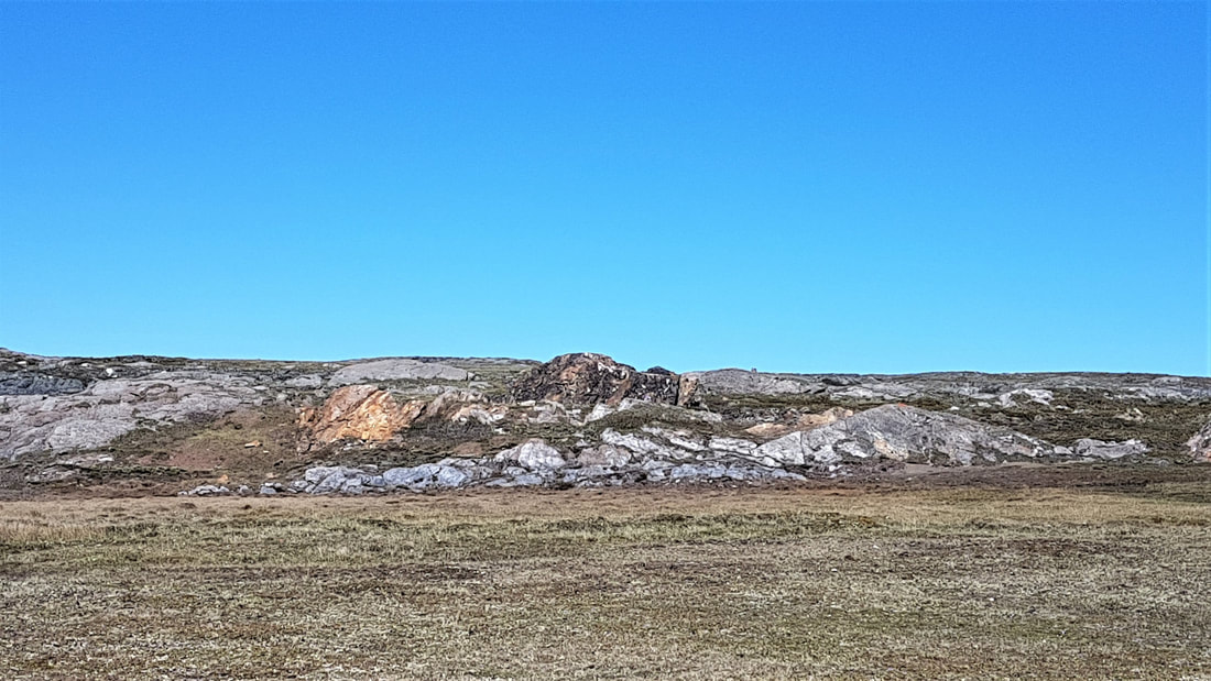
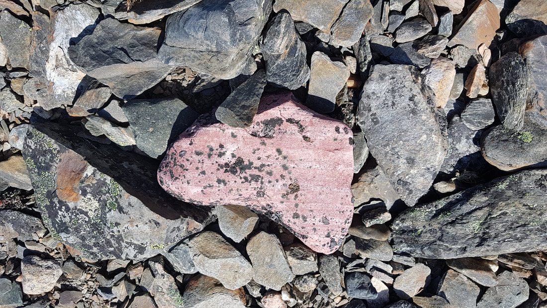
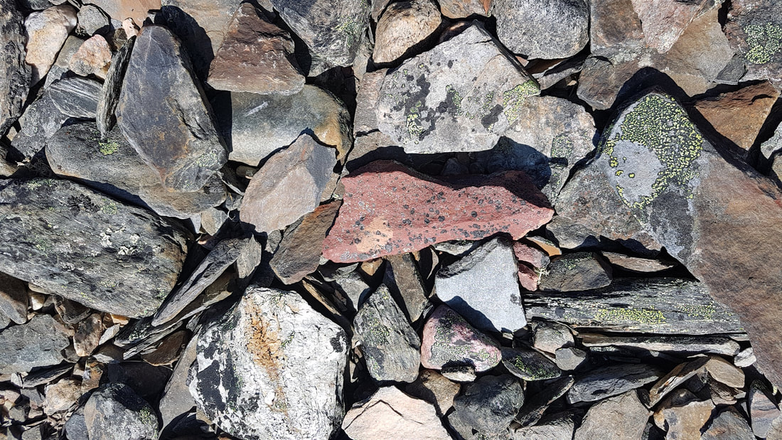
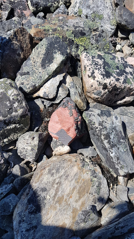
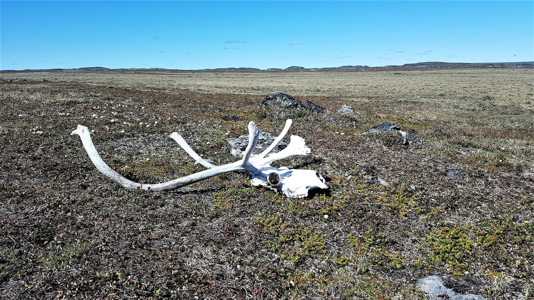
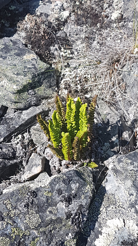
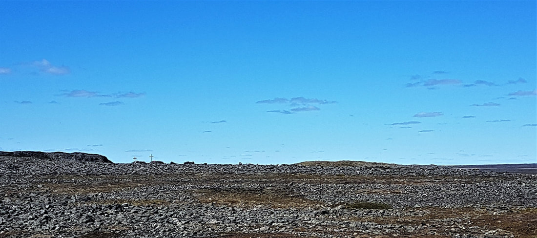
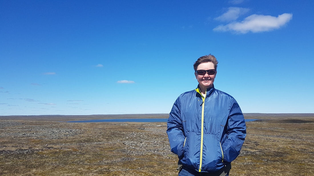
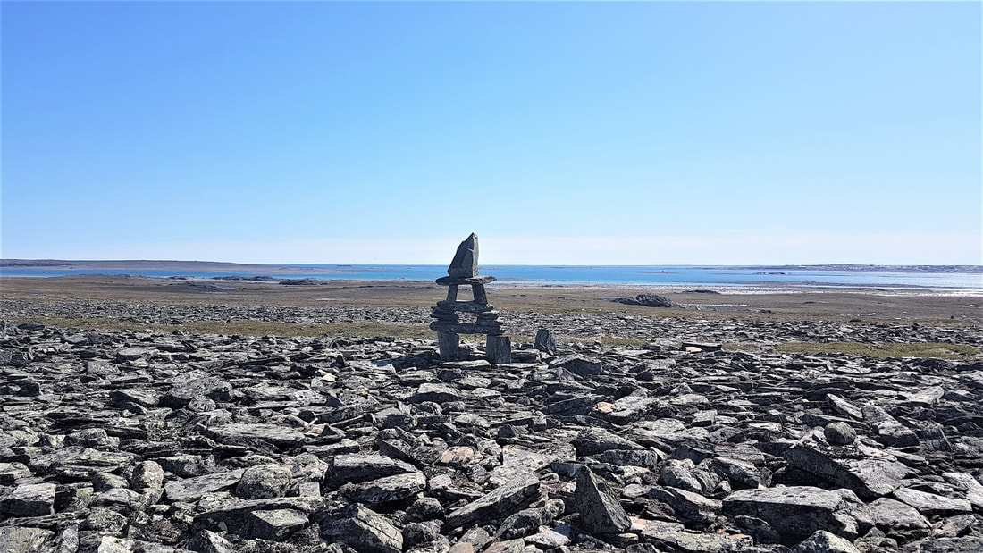
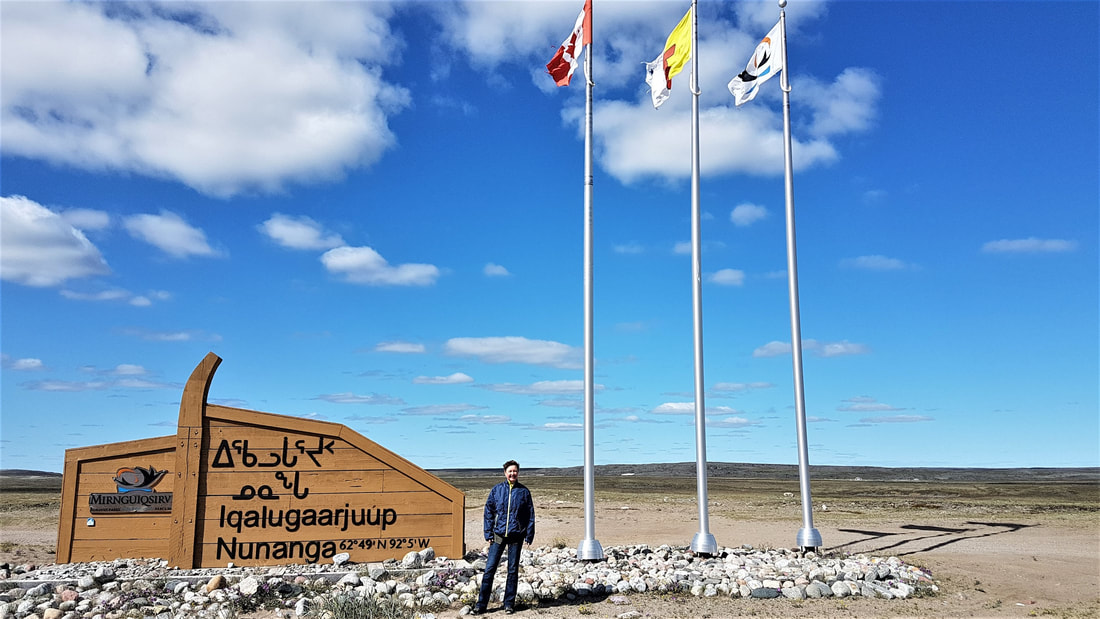
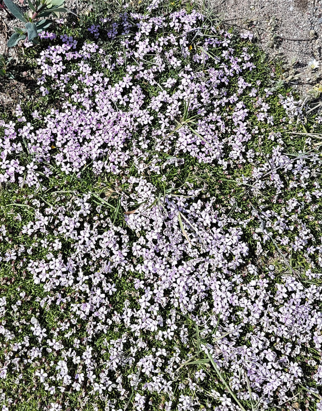
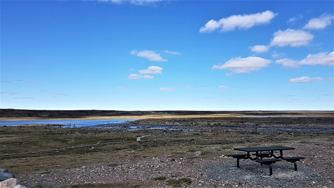
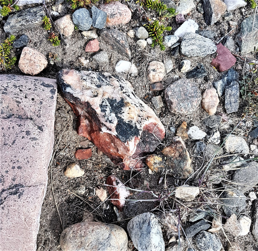
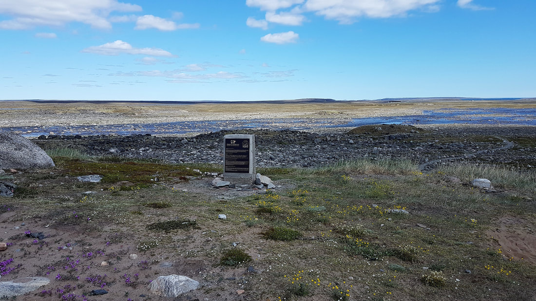
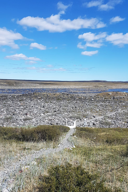
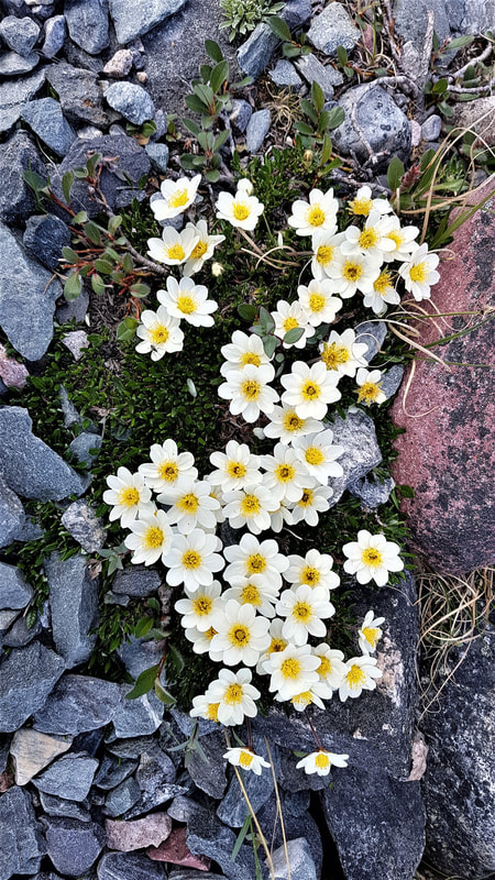
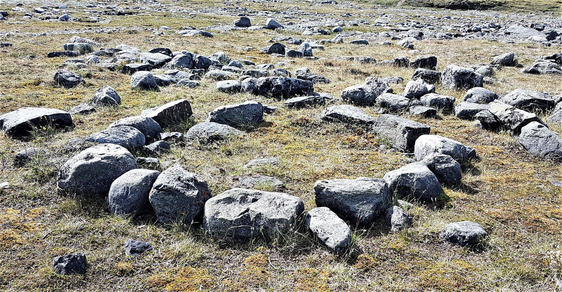
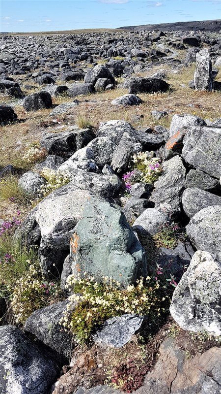
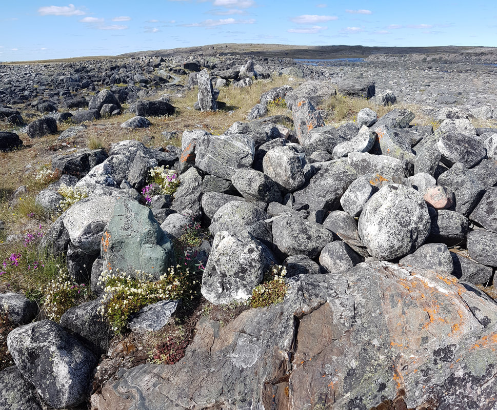
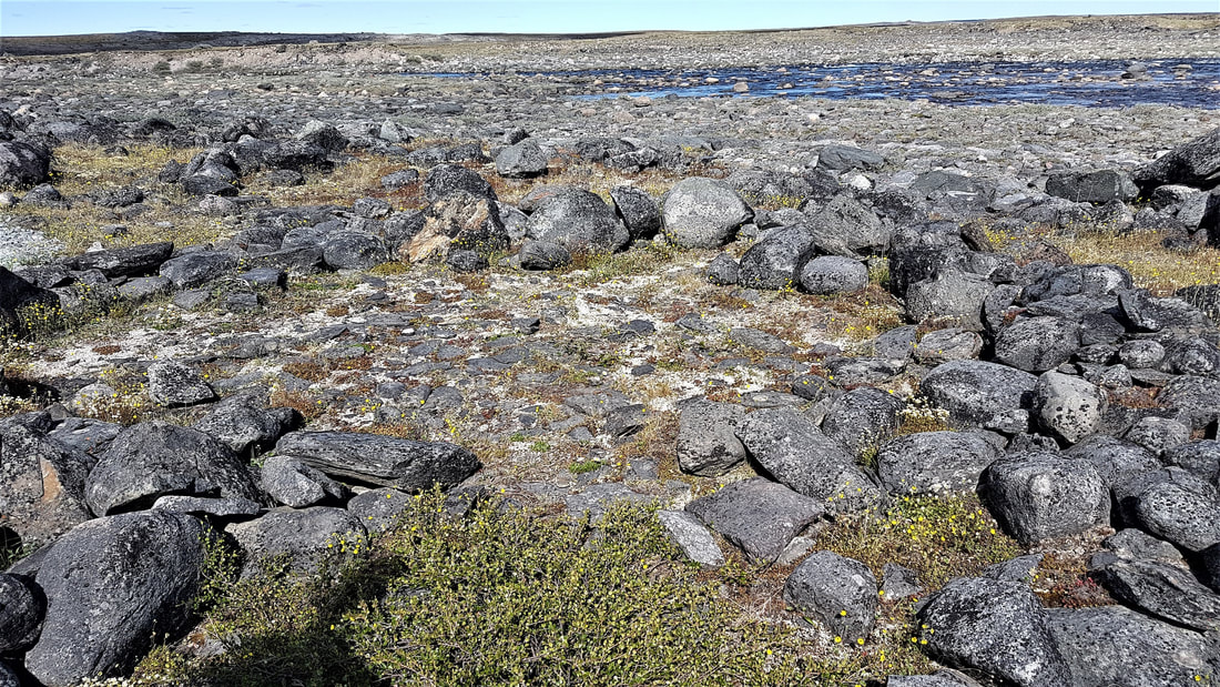
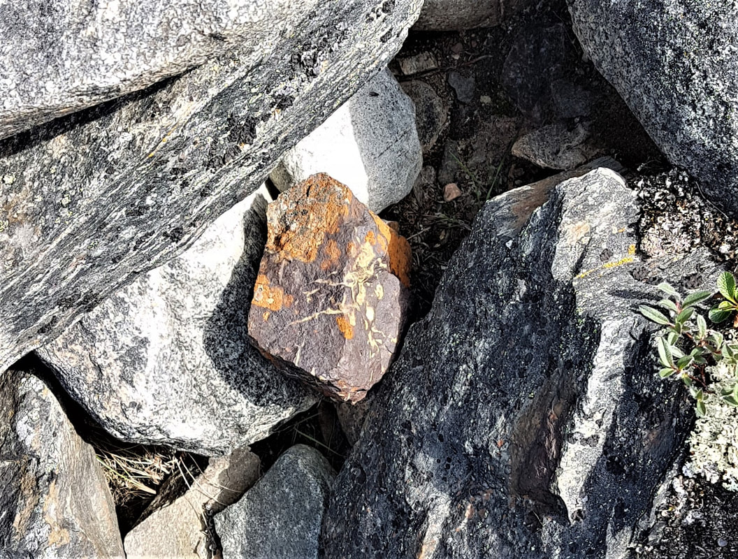
What. A. Day! Today has to rank up at the top in terms of adventure and fun. But again, all things in their proper order. 😊 So, grab a glass of wine (should prob'ly put a straw in the bottle), or a beer or a coffee or other poison of your choice and prepare for Tundra Talk – because I guarantee you this is the longest blog in this trip’s history! The short version is: I went out on a bouncy tundra tour in a side-by-side with a local guide and saw stuff – flowers, rocks, birds, water, mud, dust, and an ancient historic site. If that’s all you want to know, ta-da! You’re done. For the rest of you, I will try to be more interesting than a university professor, but the tale of it cannot even come close to the experience. The day began with the complimentary breakfast that Katimavik Suites serves in their community kitchen. So aside from good rooms with great showers and beds, I can add a plug for breakfast. About 3 people now have told me I picked the best place to stay in Rankin Inlet. I sat down at a table with Eleanor – a fellow guest – and we had a good chat. She has been here for a couple of months working. She said there have been jade and gemstone discoveries that are expected to bring more mining activity to the area, which is good and bad. While this is good for jobs and training opportunities for the north, it also encourages the disposable culture and destruction of land for rather frivolous minerals. When I arrived at the hotel yesterday, I asked if there was anyone local that would take me out for a tour on short notice. It was suggested that I contact Doug McLarty at Arctic Tours. I did so as soon as I got settled in my room and left a message with his wife. He called me back pretty promptly to say he could take me out for the day and arranged to pick me up at 11:00 a.m. today. Couldn’t believe my good luck and held my breath that nothing would come up to prevent the day’s adventure. Doug picked me up in a side-by-side promptly at 11:00, accompanied by his son Kevin, who followed in a quad in case we got into trouble. We began at the site of the old North Rankin Inlet Nickel Mine in town, which is the reason Rankin Inlet is on the map. It really did not exist as a community prior to that, as it was only a pass-through for the Inuit, following herds of caribou. The mine operated from 1957-62 and was the first mining operation to employ Inuit people. It was an underground operation with a massive shaft that brought the ore to the surface for crushing, separation and concentration. All that remains of it are some crushers and a concentration plant. However, it opened the door for mineral extraction in the north and Rankin Inlet is now a hub for industry throughout Nunavut. The fuel tank farm is visible from the old mine site. A 2-year supply is maintained there and everything is diesel electric. As mentioned yesterday, fuel supply throughout Nunavut is managed by government, as is power supply. A company called Agnico Eagle is developing a new gold reserve that is expected to go into production in 2019 and they have their own fuel tanks for supply, but they still have to go through the government petroleum division to have it brought in. Food is also delivered via sea lift and there is typically a full year’s supply of non-perishable food stocked, with perishables being flown in regularly. Perishables are heavily subsidized by the government to make them more affordable to the residents, though this is not an easy task to manage. Telecommunications in the area are provided by one company and are all satellite. No high-speed fibre optics in Nunavut! On our way out of town, we drove by the Nunavut Arctic College which has been a success here. It provides a great deal of trades training and prepares students for continuing on to other programs outside of Nunavut. Kind of like Okanagan College, students can take a variety of courses that will lead into diplomas and degrees, enabling them to do their first one or two years of a program before having to go out of Nunavut to finish it. While trades and industry are a big part of the work opportunities here, students have also been able to pursue nursing and teaching degrees and have returned to put those degrees to work in the north. Passing through town, we saw the Healing Centre, a striking building which was erected to help address Nunavut’s correctional needs. While it does have cells for retention, it is not a typical jail, having a focus of rehabilitation through traditional Inuit ways. We drove by a small lake which provides the community with its fresh water. According to Doug, Rankin Inlet is the only community in Nunavut that has its own water supply on a continuous loop. A growing population has taxed the supply and additional water is pumped through another lake close by to address the need. Rankin Inlet is essentially a northern “cold” desert, with very little rain and only 12-18” of snow annually. It relies heavily on its sparse snow fall to replenish the surrounding fresh water reservoirs and the decline in snowfall and rain has had an impact. Also on the way out is a large antenna ray which measures magnetic fields in the north. These radars measure space-weather wind maps and monitor it for its impact on satellite communications. Too complicated for my simple brain, more information can be found at http://nwtresearch.com/research-projects/space/space-weather-polardarn. Finally, it was on and out to the nature surrounding Rankin Inlet! This was a huge bonus for me. I did have the opportunity to rent a truck to investigate the area on my own, but would never have seen and experienced all that I did by riding around the tundra with Doug and Kevin. Doug’s tongue-in-cheek reference to the Rankin Inlet Superhighway is a narrow trail through the tundra and that can change daily based on the behaviour of the weather and perma-frost. The trail can go from dry to muddy to driving through little lakes all within one kilometer. Definitely not a motorcycle route and only suitable for a vehicle like a side-by-side or ATV. There must have been times when Kevin was crossing his fingers as he followed us, that he wouldn’t have to push us out of the mud! I was amazed at what that vehicle could get through. Not a tour for the feint of heart or weak of stomach..... We stopped at the top of a hill to see some graves marked by a cross. There is a cemetery in Rankin Inlet, but many elders choose to be buried on the land in the traditional way – wrapped in canvas and then covered with a rock cairn. Graves cannot be dug, of course, because there’s no soil to dig down into and the permafrost is only a few inches from the surface. Continuing on, we stopped at a fox den that Doug had seen kits in a couple of weeks ago. We didn’t see any foxes but could see the various holes of their den – gotta have more than one escape route! While there is red fox in other areas of Nunavut, the most common around Rankin Inlet is the arctic fox. We encountered the same experience with the Perigrine Falcon nests he had seen. He said they go to a good deal of trouble to lay their eggs in concealed ledges in the rocky outcrops, then announce the presence of them by screeching at you if you get close. It is pretty rare to see polar bears or grizzly bears around Rankin Inlet. This is more common around Arviat, many kilometers south of Rankin Inlet. The big news that gets everyone excited here is the caribou migration. They move from Churchill to Baker Lake over the spring and summer, have their babies in the Baker Lake area and then migrate back to Churchill for the winter. As they do, they pass through Rankin Inlet in the 10s of thousands. It is not a matter of this happening once and it’s all over – they move into the wind (probably to avoid the mosquitoes!) and so may move zig zag across the landscape. When they appear, the hunt is on and animals are killed as needed. It is common to see bones, jaws and antlers on the tundra as the caribou are most often butchered on the tundra and the un-needed parts left for the foxes and birds to strip clean. When the caribou are on the move through the area, all functions at the nearby mine site stop. Roads are shut down, operations cease, no trucks are permitted up and down the road and even shift changes are cancelled because vehicles can’t be sent in to get the workers. It is a condition of the permit to operate that there is zero interference with the caribou migration. They must stay in a holding pattern until the caribou move on. The landscape can change from granite outcrops to sand to shale almost instantly across the coastline. As we were riding along, I said “oh look – snow under those little hillocks”. Doug stopped the vehicle and told me it's actually ice raising the ground as it thaws and freezes. I looked closer and sure enough – a solid block of ice visible under the tundra! It was pretty exciting to see the permafrost layer right there, thrusting up through the tundra! There is habitat for peregrine falcons, seagulls, plovers, sandhill cranes, tundra swans and many other species of bird. The Rankin Inlet area has a variety of migrating birds, although the populations of migrating songbirds and sandhill cranes have been declining. Doug pointed out that far off in the direction we were heading lay Marble Island. The rock, laced with quartzite makes it look like white marble. This is where James Knight and his crew perished while attempting to find the northwest passage, not realizing that Hudson Bay was an enclosed body of water. It’s possible they were caught in the winter, after the migration of beluga and caribou and died of starvation. Doug said if it’s a perfect day and the water is clear, the lost ship can actually be seen through the water. The Inuit have a legend about Marble Island as well and there are different variations of it. This link appears to be the most common story: http://www.marbleisland.ca/history03.html#creation We stopped for lunch at a rocky outcrop that provided some shelter from the ever-present wind and therefore also provided a buffet for the mosquitoes. I had a bug-spray bath, which helped keep them at thumbs-length while having lunch so I didn’t eat them along with our sandwich. We talked about the tundra flora – arctic blueberries, arctic heather, saxifrage and different lichens. Nature is a remarkable artist. On the way to it, and at the spot we stopped for lunch, we saw several caribou trails. So narrow, you would not identify them as such, but it is explained by the caribou’s “follow-the-leader” behaviour. It must make them much easier to hunt when they are spread out in a string while moving. I was intrigued by the numerous inuksuks we saw along the way. The dictionary definition of “ a structure of rough stones stacked in the form of a human figure” is only partly correct. There are none of these “human figures” on the tundra as inuksuk. Rather the ones we saw are for navigation – directional markers to help travellers find their way. Particularly in the winter where blizzards can quickly disorient you. The Canadian Encyclopedia site more accurately describes them as: “Inuksut are placed throughout the Arctic landscape acting as "helpers" to the Inuit. Among their many practical functions, they are used as hunting and navigational aids, coordination points and message centres (e.g., they might indicate where food was cached). In addition to their earthly functions, certain inuksuk-like figures have spiritual connotations, and are objects of veneration, often marking the spiritual landscape of the Inummariit — the Inuit who know how to survive on the land living in their traditional way.” Knowing that Nunavut has a dizzying array of mineralogy, it was still fascinating to see the variety of it everywhere we went. The whole area was a continental ice sheet. As it receded, it left the Meliadine Esker, which has conveniently provided a route for roads among the water. The glacial rebound along the coast that causes the land to rise is still going on. Of course, the other result was the exposure of pretty rocks everywhere! Not to mention displays of indicator minerals that would have geologists dancing with excitement at the possibility of what lay below. So today, you get pictures of flowers, rivers, lakes AND rocks! Lucky you. I was surprised to learn that there is a fair bit of seafood in the waterways. The area around Rankin Inlet has bodies of both salt water and fresh water, so seafood like mussels, crabs, shrimp and clams is not uncommon. The “local” fish is arctic char, which sounds as though it is a bit different from that in the Yukon - like salmon, they say here – pink in the spring and redder in the fall. There is no fishery here anymore, but the locals still fish for char, grayling and trout. We concluded our tour with a visit to the Iqalugaarjuup Nunanga Park. The guidebook for the park is very interesting, with information on the Inuktitut language, the flora and fauna of the area and the historic Thule site in the park. The earliest arctic people discovered so far date back to 4000 years ago and the Thule culture is thought to have spread rapidly eastward from Alaska during the period from 900-1200 AD. The site includes the remnants of tent rings (rings of stone for summer tents), autumn houses (recessed structures believed to be covered with skins for shelter), and a burial ground marked by a large rock cairn. There was no need for Tracey to whisper to me where to leave some of her ashes in Nunavut and as I watched them blow on the arctic breeze, I was filled with gratitude that I got here. As I wrote earlier, the tale can’t possibly weave the spell of the arctic. Nunavut is stark, rugged, barren and beautiful. I suspect it is also unforgiving if you don’t know what you’re doing. Yet it weaves that engaging spell of peace that I have found all over the north of Canada. Arriving back at the hotel just before 5:00 p.m., I had a quick shower before heading out for dinner. While a mixture of bug spray and dust makes an admirable hair styling product – you can do anything with it, including make it stand up on end – I thought it might be a bit odorous for public eating establishments. Returning from dinner, I have rambled on for far too long and still have to sift through the million pictures I took. If you find yourself in Rankin Inlet, or in need of an adventure, give Doug a call or visit his site at arctictours.ca – his card is below – and he’ll make it happen if he can, for a very reasonable rate. He also does fabulous photography and photography tours. I had best stop talking and get at it if this blog is ever to be posted! If you have managed to read this far, thank you for joining me on this fabulous adventure today!
3 Comments
dad & shirl
7/16/2018 04:46:57 am
totally love it.but affraid it is a long way down on the things i will get done.<so sad> 9/11/2023 12:15:18 am
"Fascinating read! Your journey along the Rankin Inlet Superhighway was vividly described, making me feel like I was right there with you. Thanks for sharing this exciting adventure!" 9/11/2023 01:04:18 am
I felt like I was right there with you as you narrated your voyage through the Rankin Inlet Superhighway. I appreciate you sharing your adventure. Leave a Reply. |


 RSS Feed